Area Overview for DL13 1PR
Photos of DL13 1PR
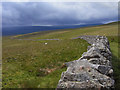
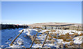
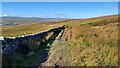
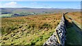
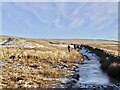
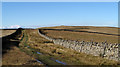
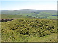
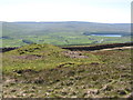
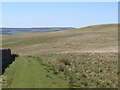
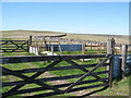
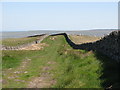
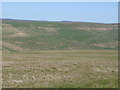
22 photos from this area
Area Information
Key information about the DL13 1PR including its size, population, and administrative classification.
- Area Type
- Postcode
- Area Size
- 2.4 km²
- Population
- 1466
- Population Density
- 14 people/km²
House Prices in DL13 1PR
9
Properties
£286,000
Average Sold Price
£175,000
Lowest Price
£429,000
Highest Price
Showing 9 properties
| Address | Type | Beds | Baths | Last Sale Price | Last Sale Date | |
|---|---|---|---|---|---|---|
| Newfield, Unc 22.2 From Well Bank To Burtree Ford, Wearhead, DL13 1PR | Detached | 4 | 3 | £429,000 | Dec 2024 | |
| Sedling Cottage, Unc 22.2 From Well Bank To Burtree Ford, Wearhead, DL13 1PR | Detached | 3 | 1 | £240,000 | Sep 2023 | |
| Bail Hill, Unc 22.2 From Well Bank To Burtree Ford, Wearhead, DL13 1PR | Detached | 3 | 1 | £300,000 | Nov 2021 | |
| Halliwell House, Unc 22.2 From Well Bank To Burtree Ford, Wearhead, DL13 1PR | Farm | 2 | 1 | £175,000 | Aug 2019 | |
| Cornfield House, Unc 22.2 From Well Bank To Burtree Ford, Wearhead, DL13 1PR | Detached | 4 | - | - | - | |
| Caravans 1 And 2, Bail Hill, Sedling Plain, Wearhead, DL13 1PR | Mobile Home | - | - | - | - | |
| Caravan No 2, Bail Hill, Sedling Plain, Wearhead, DL13 1PR | Mobile Home | - | - | - | - | |
| Hillview, Unc 22.2 From Well Bank To Burtree Ford, Wearhead, DL13 1PR | house | - | - | - | - | |
| Elmford Bridge, Unc 22.2 From Well Bank To Burtree Ford, Wearhead, DL13 1PR | commercial | - | - | - | - |
Energy Efficiency in DL13 1PR
Amenities
Schools
| Rank | School | Type | Entry gender | Ages |
|---|
Explore more schools in this area
Go to Schools tabDemographics
Household Size
Two person
most common
Accommodation Type
Houses
most common
Tenure
84
majority
Ethnic Group
White
most common
Religion
N/A
most common
Household Composition
N/A
most common
Age
47
median
Adults (30-64 years)
most common
Household Deprivation
N/A
with no deprivation
NS-SEC
35
in Lower managerial occupations
Explore more demographic insights in this area
Go to Demographics tabPlanning
Planning Constraints
- Flood RiskPremium
- Ramsar Wetland SitesPremium
- Area of Outstanding Natural BeautyPremium
- Protected Nature ReservePremium
- Protected WoodlandPremium