Area Overview for DL13 1LN
Photos of DL13 1LN
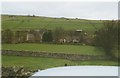
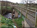
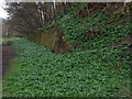
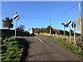

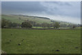
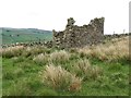
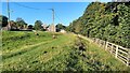
39 photos from this area
Area Information
Key information about the DL13 1LN including its size, population, and administrative classification.
- Area Type
- Postcode
- Area Size
- 9288 m²
- Population
- 1466
- Population Density
- 14 people/km²
House Prices in DL13 1LN
11
Properties
£150,000
Average Sold Price
£150,000
Lowest Price
£150,000
Highest Price
Showing 11 properties
| Address | Type | Beds | Baths | Last Sale Price | Last Sale Date | |
|---|---|---|---|---|---|---|
| 4B BRITTON HALL, Westgate, DL13 1LN | Semi-detached | 2 | 1 | £150,000 | Apr 2023 | |
| 1 Britton Hall, Westgate, DL13 1LN | Terraced | 3 | 1 | - | - | |
| 4A Britton Hall, Westgate, DL13 1LN | Semi-detached | 2 | 1 | - | - | |
| 2 Britton Hall, Westgate, DL13 1LN | house | 3 | 1 | - | - | |
| 4, Britton Hall, C 28 From A 689 Junc To C 74 Crossroads, Westgate, DL13 1LN | undefined | - | - | - | - | |
| 10 Westgate Caravan Site, Britton Hall, C 28 From A 689 Junc To C 74 Crossroads, Westgate, DL13 1LN | Mobile Home | - | - | - | - | |
| 3 Britton Hall, Westgate, DL13 1LN | Terraced | - | - | - | - | |
| Westgate Camping Site, Britton Hall, C 28 From A 689 Junc To C 74 Crossroads, Westgate, DL13 1LN | commercial | - | - | - | - | |
| 5, Britton Hall, C 28 From A 689 Junc To C 74 Crossroads, Westgate, DL13 1LN | Detached | - | - | - | - | |
| 6, Britton Hall, C 28 From A 689 Junc To C 74 Crossroads, Westgate, DL13 1LN | Detached | - | - | - | - |
Page 1 of 2
Energy Efficiency in DL13 1LN
Amenities
Schools
| Rank | School | Type | Entry gender | Ages |
|---|
Explore more schools in this area
Go to Schools tabDemographics
Household Size
Two person
most common
Accommodation Type
Houses
most common
Tenure
84
majority
Ethnic Group
White
most common
Religion
N/A
most common
Household Composition
N/A
most common
Age
47
median
Adults (30-64 years)
most common
Household Deprivation
N/A
with no deprivation
NS-SEC
35
in Lower managerial occupations
Explore more demographic insights in this area
Go to Demographics tabPlanning
Planning Constraints
- Flood RiskPremium
- Ramsar Wetland SitesPremium
- Area of Outstanding Natural BeautyPremium
- Protected Nature ReservePremium
- Protected WoodlandPremium