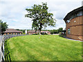
Area Overview for DL12 2AA
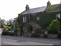
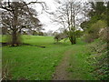
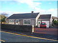
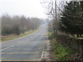
Photos of DL12 2AA


Area Information
Living in DL12 2AA means inhabiting a small, tightly knit residential cluster in England. With a population of 1,785 and a density of 582 people per square kilometre, this area is compact yet functional, offering a quiet alternative to larger urban centres. The community here is predominantly composed of adults aged 30–64, with a median age of 47, suggesting a mature, stable demographic. Daily life in DL12 2AA is shaped by its residential character, where homes are primarily owner-occupied—72% of households own their properties. This contrasts with areas where rental markets dominate, creating a sense of permanence and local investment. The area lacks major infrastructure or commercial hubs, which means residents prioritise proximity to essential services, schools, and transport links. While it is not a sprawling suburb, its small size fosters a close-knit environment where neighbours are likely to know one another. For those seeking a low-maintenance, family-friendly setting with minimal urban sprawl, DL12 2AA provides a straightforward, practical option.
- Area Type
- Postcode
- Area Size
- Not available
- Population
- 1785
- Population Density
- 582 people/km²
DL12 2AA is primarily an owner-occupied area, with 72% of households owning their homes. This contrasts with regions where rental markets dominate, suggesting a population that values stability and long-term investment. The accommodation type is largely houses, which is unusual in areas with higher apartment or flat density. This means the housing stock is likely to be family-friendly, offering more space than smaller dwellings. For buyers, this creates a niche market where properties are likely to be larger and tailored to those seeking traditional homes rather than modern, high-density living. The small size of DL12 2AA means the immediate surroundings may have limited housing diversity, so buyers should consider the broader regional context for alternative options. The high home ownership rate also implies a potentially stable property market, with less pressure from speculative investment.
House Prices in DL12 2AA
No properties found in this postcode.
Energy Efficiency in DL12 2AA
DL12 2AA’s lifestyle is defined by its proximity to essential retail and services. Nearby amenities include Lidl Barnard, Morrisons Barnard, and Co-op Barnard, providing a range of grocery and convenience shopping options. These stores are within practical reach, reducing the need for long commutes to larger centres. While the area lacks dedicated leisure or recreational facilities, the presence of multiple retail outlets suggests a focus on everyday convenience. The absence of named parks, dining venues, or cultural attractions means the lifestyle is more subdued, prioritising practicality over leisure. For residents content with a straightforward, low-maintenance routine, these amenities meet basic needs. However, those seeking a more vibrant social or cultural environment may need to look beyond DL12 2AA’s boundaries.
Amenities
Schools
DL12 2AA is served by a range of schools, including primary and secondary options. Green Lane Church of England Controlled Primary School and Teesdale School cater to younger children, while Teesdale School and Sixth Form, rated outstanding by Ofsted, provides secondary education. This mix ensures families have access to both foundational and advanced learning environments. The presence of an outstanding-rated academy suggests high academic standards and resources, which is a strong draw for parents prioritising educational quality. However, the area’s small size means school catchment areas may be limited, requiring careful consideration of proximity. The duplication of school names—such as Teesdale School appearing twice—may indicate a single institution with multiple phases or administrative entries. Regardless, the availability of both primary and secondary schooling within practical reach is a key advantage for families.
| Rank | School | Type | Entry gender | Ages |
|---|
Explore more schools in this area
Go to Schools tabDemographics
DL12 2AA’s population is defined by its age profile and home ownership patterns. The median age of 47 indicates a community skewed towards middle-aged adults, with the majority (30–64 years) forming the largest age group. This suggests a stable, established population rather than a transient one. Home ownership is high at 72%, reflecting a preference for long-term residency over renting. The accommodation type is predominantly houses, which aligns with the area’s residential character and may appeal to families seeking space. The predominant ethnic group is White, though no specific data on diversity or deprivation is provided. The absence of detailed socioeconomic breakdowns means that while the area appears to have a cohesive demographic, further local insights would be needed to assess broader inclusivity. The lack of rental properties also implies a lower turnover of residents, contributing to a consistent community feel.
Household Size
Accommodation Type
Tenure
Ethnic Group
Religion
Household Composition
Age
Household Deprivation
NS-SEC
Explore more demographic insights in this area
Go to Demographics tabPlanning
Planning Constraints
- Flood RiskPremium
- Ramsar Wetland SitesPremium
- Area of Outstanding Natural BeautyPremium
- Protected Nature ReservePremium
- Protected WoodlandPremium