Area Overview for DL1 4DF
Photos of DL1 4DF


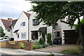
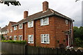
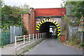
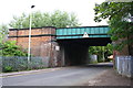
93 photos from this area
Area Information
Key information about the DL1 4DF including its size, population, and administrative classification.
- Area Type
- Postcode
- Area Size
- 2.4 hectares
- Population
- 2276
- Population Density
- 5704 people/km²
House Prices in DL1 4DF
25
Properties
£102,722
Average Sold Price
£30,000
Lowest Price
£264,000
Highest Price
Showing 25 properties
| Address | Type | Beds | Baths | Last Sale Price | Last Sale Date | |
|---|---|---|---|---|---|---|
| 175 Neasham Road, Darlington, DL1 4DF | Semi-detached | 4 | 4 | £87,000 | Aug 2023 | |
| 171 Neasham Road, Darlington, DL1 4DF | house | - | - | £133,334 | Dec 2022 | |
| 205 Neasham Road, Darlington, DL1 4DF | Detached | 4 | 2 | £264,000 | Apr 2021 | |
| 201 Neasham Road, Darlington, DL1 4DF | Semi-detached | 3 | 1 | £138,500 | Aug 2020 | |
| 190 Neasham Road, Darlington, DL1 4DF | Semi-detached | - | - | £120,000 | Nov 2015 | |
| 173 Neasham Road, Darlington, DL1 4DF | Semi-detached | 3 | 1 | £76,000 | Aug 2015 | |
| 191 Neasham Road, Darlington, DL1 4DF | Semi-detached | 3 | - | £130,000 | Aug 2015 | |
| 185 Neasham Road, Darlington, DL1 4DF | Semi-detached | - | - | £55,000 | Apr 2012 | |
| 216 Neasham Road, Darlington, DL1 4DF | house | - | - | £87,000 | Feb 2009 | |
| 173A Neasham Road, Darlington, DL1 4DF | Bungalow | 2 | 1 | £141,000 | Dec 2005 |
Page 1 of 3
Energy Efficiency in DL1 4DF
Amenities
Schools
| Rank | School | Type | Entry gender | Ages |
|---|
Explore more schools in this area
Go to Schools tabDemographics
Household Size
One person
most common
Accommodation Type
Houses
most common
Tenure
58
majority
Ethnic Group
White
most common
Religion
N/A
most common
Household Composition
N/A
most common
Age
47
median
Adults (30-64 years)
most common
Household Deprivation
N/A
with no deprivation
NS-SEC
22
in Lower managerial occupations
Explore more demographic insights in this area
Go to Demographics tabPlanning
Planning Constraints
- Flood RiskPremium
- Ramsar Wetland SitesPremium
- Area of Outstanding Natural BeautyPremium
- Protected Nature ReservePremium
- Protected WoodlandPremium