Area Overview for DL1 2UU
Photos of DL1 2UU
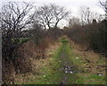
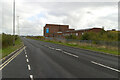
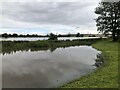
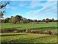
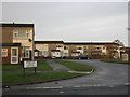
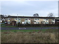
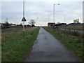
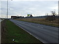
8 photos from this area
Area Information
Key information about the DL1 2UU including its size, population, and administrative classification.
- Area Type
- Postcode
- Area Size
- 2.5 hectares
- Population
- Not available
- Population Density
- Not available
House Prices in DL1 2UU
35
Properties
£139,112
Average Sold Price
£53,500
Lowest Price
£240,000
Highest Price
Showing 35 properties
| Address | Type | Beds | Baths | Last Sale Price | Last Sale Date | |
|---|---|---|---|---|---|---|
| 46 Winchester Way, Darlington, DL1 2UU | Detached | 5 | 1 | £240,000 | Jun 2025 | |
| 34 Winchester Way, Darlington, DL1 2UU | Semi-detached | 3 | 1 | £146,750 | Sep 2023 | |
| 30 Winchester Way, Darlington, DL1 2UU | Semi-detached | 3 | 1 | £150,000 | Aug 2023 | |
| 73 Winchester Way, Darlington, DL1 2UU | house | - | - | £210,000 | Oct 2021 | |
| 50 Winchester Way, Darlington, DL1 2UU | Detached | 4 | 1 | £205,000 | Dec 2019 | |
| 55 Winchester Way, Darlington, DL1 2UU | Bungalow | - | - | £175,000 | Sep 2019 | |
| 79 Winchester Way, Darlington, DL1 2UU | house | 3 | - | £170,000 | Aug 2018 | |
| 49 Winchester Way, Darlington, DL1 2UU | Bungalow | 2 | - | £147,000 | Jul 2017 | |
| 59 Winchester Way, Darlington, DL1 2UU | Bungalow | 3 | - | £182,500 | Nov 2015 | |
| 41 Winchester Way, Darlington, DL1 2UU | Bungalow | - | - | £159,950 | May 2015 |
Page 1 of 4
Energy Efficiency in DL1 2UU
Amenities
Schools
| Rank | School | Type | Entry gender | Ages |
|---|
Explore more schools in this area
Go to Schools tabDemographics
Household Size
Two person
most common
Accommodation Type
Houses
most common
Tenure
75
majority
Ethnic Group
White
most common
Religion
N/A
most common
Household Composition
N/A
most common
Age
47
median
Adults (30-64 years)
most common
Household Deprivation
N/A
with no deprivation
NS-SEC
28
in Lower managerial occupations
Explore more demographic insights in this area
Go to Demographics tabPlanning
Planning Constraints
- Flood RiskPremium
- Ramsar Wetland SitesPremium
- Area of Outstanding Natural BeautyPremium
- Protected Nature ReservePremium
- Protected WoodlandPremium