Area Overview for DL1 2RD
Photos of DL1 2RD

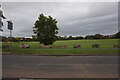
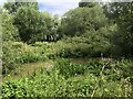
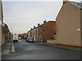

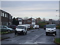
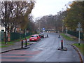
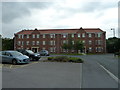
8 photos from this area
Area Information
Key information about the DL1 2RD including its size, population, and administrative classification.
- Area Type
- Postcode
- Area Size
- 7995 m²
- Population
- 1072
- Population Density
- 134092 people/km²
House Prices in DL1 2RD
14
Properties
£124,996
Average Sold Price
£45,000
Lowest Price
£184,000
Highest Price
Showing 14 properties
| Address | Type | Beds | Baths | Last Sale Price | Last Sale Date | |
|---|---|---|---|---|---|---|
| 11 Wylam Avenue, Darlington, DL1 2RD | Detached | 3 | 2 | £180,000 | Apr 2023 | |
| 1 Wylam Avenue, Darlington, DL1 2RD | Detached | 3 | 2 | £184,000 | Dec 2020 | |
| 23 Wylam Avenue, Darlington, DL1 2RD | Bungalow | - | - | £178,000 | Oct 2017 | |
| 15 Wylam Avenue, Darlington, DL1 2RD | Bungalow | - | - | £172,000 | Jun 2016 | |
| 9 Wylam Avenue, Darlington, DL1 2RD | house | - | - | £176,500 | Sep 2010 | |
| 7 Wylam Avenue, Darlington, DL1 2RD | Bungalow | - | - | £134,000 | Jun 2010 | |
| 25 Wylam Avenue, Darlington, DL1 2RD | Detached | - | - | £180,000 | Aug 2007 | |
| 29 Wylam Avenue, Darlington, DL1 2RD | Bungalow | 3 | - | £45,000 | Aug 2005 | |
| 27 Wylam Avenue, Darlington, DL1 2RD | Detached | 2 | 1 | £61,500 | Sep 2000 | |
| 17 Wylam Avenue, Darlington, DL1 2RD | Terraced | - | - | £72,000 | Jan 2000 |
Page 1 of 2
Energy Efficiency in DL1 2RD
Amenities
Schools
| Rank | School | Type | Entry gender | Ages |
|---|
Explore more schools in this area
Go to Schools tabDemographics
Household Size
Two person
most common
Accommodation Type
Houses
most common
Tenure
90
majority
Ethnic Group
White
most common
Religion
N/A
most common
Household Composition
N/A
most common
Age
47
median
Adults (30-64 years)
most common
Household Deprivation
N/A
with no deprivation
NS-SEC
35
in Lower managerial occupations
Explore more demographic insights in this area
Go to Demographics tabPlanning
Planning Constraints
- Flood RiskPremium
- Ramsar Wetland SitesPremium
- Area of Outstanding Natural BeautyPremium
- Protected Nature ReservePremium
- Protected WoodlandPremium