Area Overview for DL1 1TS
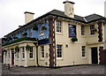
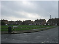
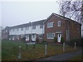
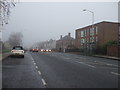
Photos of DL1 1TS


Area Information
DL1 1TS is a compact residential postcode in England, home to 2,694 people spread across a densely populated area of 2,437 people per square kilometre. This small cluster of homes reflects a community characterised by stability and family-oriented living. The area’s proximity to essential services, including schools, rail networks, and retail hubs, makes it practical for daily life. With a median age of 47 and a majority of residents aged 30–64, the population leans towards professionals and families. The mix of houses and the relatively high home ownership rate of 55% suggests a long-term presence of residents. While the area lacks natural landscapes like AONBs or protected woodlands, its accessibility to nearby towns and transport links offers flexibility. Living here means navigating a tight-knit environment with practical amenities, though the density may feel limiting for those seeking larger spaces. The balance of convenience and community is key for those considering DL1 1TS as a base.
- Area Type
- Postcode
- Area Size
- Not available
- Population
- 2694
- Population Density
- 2437 people/km²
DL1 1TS is primarily a home-owning area, with 55% of properties owned by residents rather than rented. The accommodation type is predominantly houses, which suggests a focus on family homes rather than apartments or flats. This composition may appeal to buyers seeking long-term stability, though the small size of the postcode means the housing stock is limited. The high home ownership rate indicates a community with established residents, which can be a draw for those looking for a settled environment. However, the lack of data on rental availability or property prices means buyers should consider nearby areas for more options. The presence of schools and transport links also makes this area attractive for families, though the density may limit larger properties.
House Prices in DL1 1TS
No properties found in this postcode.
Energy Efficiency in DL1 1TS
The lifestyle in DL1 1TS is supported by a range of nearby amenities, from retail to transport. Within practical reach are five retail outlets, including Iceland Yarm, Aldi Lascelles, and Spar Darlington, providing everyday shopping needs. The area’s rail network, with five stations, offers easy access to towns and cities, while two airports ensure convenient travel options. Though the data does not mention parks or leisure facilities, the presence of schools and retail suggests a focus on practicality over leisure. The compact nature of the area means amenities are close, but residents may need to travel further for more specialised services. The mix of shops, transport, and education creates a functional environment, ideal for those valuing convenience and connectivity over expansive recreational spaces.
Amenities
Schools
DL1 1TS is served by a range of educational institutions, from early years to sixth-form education. Heathfield Nursery School and Heathfield Primary School provide early and primary education, while Eastbourne Comprehensive School, listed as a primary school in the data, may indicate a local focus on foundational learning. Darlington College offers sixth-form education, and the Darlington Alternative Centre for Education caters to other educational needs. This mix of school types ensures families have options for their children’s education, from nursery through to further study. The presence of both traditional and alternative institutions suggests a diverse approach to learning, though no Ofsted ratings are provided. For parents, the proximity of these schools is a practical advantage, reducing travel time and supporting a family-oriented lifestyle.
| Rank | School | Type | Entry gender | Ages |
|---|
Explore more schools in this area
Go to Schools tabDemographics
The demographic profile of DL1 1TS is defined by a median age of 47, with the largest age group being adults aged 30–64. This suggests a community of established professionals and families, rather than a younger or elderly population. Home ownership stands at 55%, indicating a mix of owner-occupied properties and rental units, though the exact proportion of renters is not specified. The predominant accommodation type is houses, which aligns with the age profile of homeowners seeking family-friendly living. The predominant ethnic group is White, though no data is provided on other ethnicities or diversity metrics. The absence of specific deprivation statistics means the quality of life cannot be assessed in that context, but the age and ownership figures imply a relatively stable, middle-income community.
Household Size
Accommodation Type
Tenure
Ethnic Group
Religion
Household Composition
Age
Household Deprivation
NS-SEC
Explore more demographic insights in this area
Go to Demographics tabPlanning
Planning Constraints
- Flood RiskPremium
- Ramsar Wetland SitesPremium
- Area of Outstanding Natural BeautyPremium
- Protected Nature ReservePremium
- Protected WoodlandPremium