Area Overview for DL1 1LW
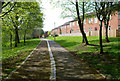
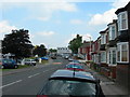
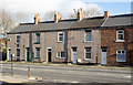
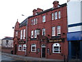
Photos of DL1 1LW


Area Information
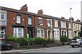
DL1 1LW is a small, compact postcode area in England, home to 2098 residents spread across a densely populated landscape of 1855 people per square kilometre. This residential cluster is defined by its proximity to essential services and transport links, making it a practical choice for those prioritising convenience. The area’s character is shaped by its demographic profile: predominantly adults aged 30–64, with a median age of 47. While the housing stock is largely composed of flats, the community feels tightly knit, with amenities within easy reach. Residents benefit from nearby rail stations, including North Road and Darlington, and proximity to Durham Tees Valley Airport, which enhances connectivity. The area’s compact nature means daily life revolves around local shops, schools, and transport hubs, creating a self-contained environment. However, its small size also means the housing market is limited, with a low home ownership rate of 24%, suggesting a rental-dominated landscape. For buyers, this area offers a blend of practicality and accessibility, though its size may restrict options.
- Area Type
- Postcode
- Area Size
- Not available
- Population
- 2098
- Population Density
- 1855 people/km²
DL1 1LW’s property market is characterised by a low home ownership rate of 24%, indicating that the majority of residents are renters rather than homeowners. The accommodation type is predominantly flats, which suggests a housing stock tailored to smaller households or individuals. This configuration is typical of urban or semi-urban areas where space is limited, and shared living is practical. The small size of the postcode area means the housing market is likely constrained, with limited new developments or property turnover. For buyers, this presents a challenge: the availability of flats may be limited, and the area’s compact nature could reduce competition for larger properties. However, the presence of nearby rail stations and proximity to airports may make it appealing for commuters or those seeking easy access to transport. Prospective buyers should consider the rental-heavy nature of the market and the potential for fewer options in a small, densely populated area.
House Prices in DL1 1LW
No properties found in this postcode.
Energy Efficiency in DL1 1LW
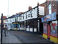
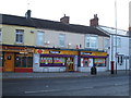
DL1 1LW offers a range of amenities within practical reach, including five retail outlets such as Aldi North Road, Iceland North, and Sainsburys Corporation. These shops provide everyday essentials, contributing to a convenient lifestyle for residents. The area’s proximity to rail stations and airports ensures easy access to broader regional networks, whether for commuting or travel. While the data does not mention parks or leisure facilities, the compact nature of the area suggests that amenities are closely clustered, reducing the need for long commutes. The presence of multiple retail options and transport links indicates a community focused on practicality and accessibility. For those valuing convenience, DL1 1LW’s lifestyle is defined by its proximity to services and its integration with transport infrastructure, making daily life efficient and straightforward.
Amenities
Schools
The nearest school to DL1 1LW is Borough Road Nursery School, which provides early education for young children. No other schools are listed in the data, meaning families with older children may need to look beyond the immediate area for primary or secondary education. The presence of a nursery suggests that the community includes households with young children, though the absence of higher-tier schools indicates a reliance on nearby districts for broader educational needs. For parents seeking a range of school options, DL1 1LW may require additional research into surrounding areas. The nursery’s inclusion aligns with the area’s demographic profile of adults aged 30–64, who may be raising children in a compact residential setting. However, the limited school infrastructure within the postcode highlights the importance of proximity to other districts for comprehensive education.
| Rank | School | Type | Entry gender | Ages |
|---|
Explore more schools in this area
Go to Schools tabDemographics
The population of DL1 1LW is predominantly adults aged 30–64, with a median age of 47. This suggests a mature, stable community with a focus on established households. Only 24% of residents own their homes, indicating a rental market that dominates the area. The accommodation type is primarily flats, reflecting a lack of larger properties or detached homes. The predominant ethnic group is White, with no data provided on other demographics. The high population density of 1855 people per square kilometre implies a compact, possibly urban setting, where shared living spaces are common. While the data does not specify deprivation levels, the low home ownership rate and flat-based housing suggest a mix of younger professionals and long-term renters. The absence of detailed diversity metrics means the community’s broader social composition remains less defined, but the age profile points to a population that is largely settled and perhaps less transient than younger demographics.
Household Size
Accommodation Type
Tenure
Ethnic Group
Religion
Household Composition
Age
Household Deprivation
NS-SEC
Explore more demographic insights in this area
Go to Demographics tabPlanning
Planning Constraints
- Flood RiskPremium
- Ramsar Wetland SitesPremium
- Area of Outstanding Natural BeautyPremium
- Protected Nature ReservePremium
- Protected WoodlandPremium