Area Overview for DL1 1AA
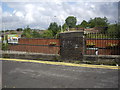
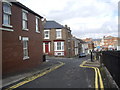
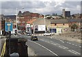
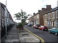
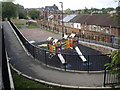
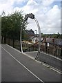
Photos of DL1 1AA


Area Information
Living in DL1 1AA offers a distinct experience within the Darlington postcode cluster. This small residential area covers just 1.1 hectares, yet it accommodates a population of 2,098 people. The high population density of 1,855 people per square kilometre creates a compact living environment typical of urban residential clusters. Your daily life here is defined by proximity to major transport hubs and commercial centres. Three railway stations lie within practical reach, including Darlington Railway Station, North Road Railway Station, and Dinsdale Railway Station. Two Durham Tees Valley Airport facilities are also located nearby, providing travel options for residents commuting beyond the immediate region. The neighbourhood includes significant retail options that dominate local commerce. Residents can access Sainsburys Clifton, Tesco Cornmill, and M&S Darlington WHS, ensuring everyday shopping needs are met without long travel distances. This concentration of amenities supports a self-contained lifestyle where work, school runs, and leisure activities do not require extensive car journeys. The area functions as a practical base for those who value accessibility over spacious green belts. You will find that life in DL1 1AA revolves around these established utility nodes rather than open countryside. The close quarters mean you interact with your immediate neighbours more frequently than in sprawling suburban developments.
- Area Type
- Postcode
- Area Size
- 1.1 hectares
- Population
- 2098
- Population Density
- 1855 people/km²
The property market in DL1 1AA is heavily skewed towards renting rather than ownership. Only 24% of residents own their homes, which indicates a vibrant rental sector. The vast majority of the 2,098 residents living in this 1.1 hectare area rent their properties. Flats are the predominant accommodation type, which explains the high proportion of rental units. This housing stock is designed for density, making it suitable for the urban environment found in this postcode. Buyers looking at homes in DL1 1AA should expect a market dominated by private renting or affordable housing schemes rather than owner-occupied family estates. If you are seeking a purchase opportunity, the inventory will be limited compared to residential areas with strong owner-occupier rates. The prevalence of flats means you will typically find multi-storey buildings or purpose-built apartments rather than detached houses or semi-detached rows. This structure suits singles and couples well but may not meet the space requirements of large families. Understanding the home ownership percentage is vital for budgeting, as mortgage availability differs from tenancy deposits. The small area size further restricts land development, preserving the existing character as a high-density zone.
House Prices in DL1 1AA
No properties found in this postcode.
Energy Efficiency in DL1 1AA
Your daily life in DL1 1AA is supported by a strong network of retail and transport amenities within practical reach. Five retail venues serve the community, including Sainsburys Clifton, Tesco Cornmill, and M&S Darlington WHS. These supermarkets provide fresh food, household goods, and essential services, meaning you rarely need to shop outside the immediate vicinity. Dining options are readily available within these larger supermarket complexes or nearby eateries. Transport infrastructure enhances your ability to explore further afield. Five railway stations operate nearby, connecting you to Darlington Railway Station, North Road Railway Station, and Dinsdale Railway Station. These nodes offer frequent departures to major cities and regional towns. Two Durham Tees Valley Airport locations are also accessible, giving you convenient options for domestic and international flights. For leisure, the proximity to these transport hubs means you can quickly leave for parks, cinemas, or cultural sites in Darlington. The area functions as a convenient base for residents who mix local convenience with regional exploration. You will find that almost all daily necessities are within a short walk or drive.
Amenities
Schools
For families residing in DL1 1AA, the nearest educational provision consists of early years facilities rather than primary or secondary schools. Borough Road Nursery School operates on the boundaries of this postcode area. This nursery serves as the local starting point for early childhood education, providing care and development for pre-school children. While this location offers convenient access for nursery admissions, it does not cover primary education needs. Families通常需要 travel further afield to find primary or secondary institutions serving your Home School. The presence of a single nursery does not necessarily indicate a lack of schooling options in the wider neighbourhood, but it does define the immediate local provision. You should plan for longer commutes if your children require primary education, as no primary schools are listed within the immediate catchment for DL1 1AA. The limitation of just one nursery suggests that this area functions best for young children or those whose young ones do not yet engage with formal schooling. Prospective parents must look beyond this postcode to secure primary or secondary placements. The current setup relies on nearby areas in Darlington to provide comprehensive educational services beyond the nursery stage.
| Rank | School | Type | Entry gender | Ages |
|---|
Explore more schools in this area
Go to Schools tabDemographics
The community in DL1 1AA is defined by a mature demographic profile. The median age of residents is 47 years, reflecting an established population. Most households consist of adults between 30 and 64 years of age, indicating that families and empty-nesters dominate the local scene. This age group preference shapes the demand for homes that suit older residents or young professionals without children. Only 24% of households own their homes, meaning the majority live in rented accommodation. This low ownership rate contrasts with many family-oriented areas where purchase activity is higher. Accommodation types reflect this rental-heavy structure. Flats represent the predominant accommodation style in the area. This preference for flats aligns with the high density and urban character of the 1.1 hectare site. The people living here are predominantly White, which indicates a relatively homogenous ethnic composition compared to major urban centres. You will not find the diverse mix of ethnic groups common in larger cities or multicultural estates. The demographic data suggests a stable, established population that has settled in the area for the long term. Understanding these figures helps you realise that this is not a transient development but a settled community. The dominance of renters also implies that short-term tenancy agreements may be more common than purchase agreements.
Household Size
Accommodation Type
Tenure
Ethnic Group
Religion
Household Composition
Age
Household Deprivation
NS-SEC
Explore more demographic insights in this area
Go to Demographics tabPlanning
Planning Constraints
- Flood RiskPremium
- Ramsar Wetland SitesPremium
- Area of Outstanding Natural BeautyPremium
- Protected Nature ReservePremium
- Protected WoodlandPremium