Area Overview for DH9 9NR
Photos of DH9 9NR
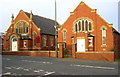
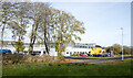
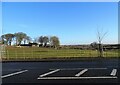
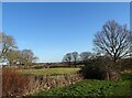
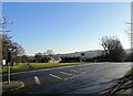
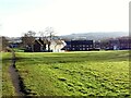
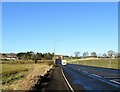
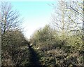
50 photos from this area
Area Information
Key information about the DH9 9NR including its size, population, and administrative classification.
- Area Type
- Postcode
- Area Size
- 4.8 hectares
- Population
- 1495
- Population Density
- 501 people/km²
House Prices in DH9 9NR
25
Properties
£67,400
Average Sold Price
£23,000
Lowest Price
£103,000
Highest Price
Showing 25 properties
| Address | Type | Beds | Baths | Last Sale Price | Last Sale Date | |
|---|---|---|---|---|---|---|
| 80 Parkside, Tanfield Lea, DH9 9NR | house | - | - | £88,000 | May 2021 | |
| 71 Parkside, Tanfield Lea, DH9 9NR | house | - | - | £103,000 | Dec 2020 | |
| 76 Parkside, Tanfield Lea, DH9 9NR | Terraced | 3 | 1 | £80,000 | Jun 2019 | |
| 69 Parkside, Tanfield Lea, DH9 9NR | Terraced | 2 | - | £67,000 | Jul 2013 | |
| 72 Parkside, Tanfield Lea, DH9 9NR | house | - | - | £58,000 | Jun 2013 | |
| 70 Parkside, Tanfield Lea, DH9 9NR | Terraced | 2 | 1 | £45,000 | Apr 2013 | |
| 85 Parkside, Tanfield Lea, DH9 9NR | Terraced | - | - | £83,000 | Jul 2005 | |
| 87 Parkside, Tanfield Lea, DH9 9NR | house | - | - | £78,000 | Jun 2004 | |
| 93 Parkside, Tanfield Lea, DH9 9NR | Terraced | - | - | £49,000 | Aug 2002 | |
| 90 Parkside, Tanfield Lea, DH9 9NR | Terraced | - | - | £23,000 | Jun 2000 |
Page 1 of 3
Energy Efficiency in DH9 9NR
Amenities
Schools
| Rank | School | Type | Entry gender | Ages |
|---|
Explore more schools in this area
Go to Schools tabDemographics
Household Size
One person
most common
Accommodation Type
Houses
most common
Tenure
57
majority
Ethnic Group
White
most common
Religion
N/A
most common
Household Composition
N/A
most common
Age
47
median
Adults (30-64 years)
most common
Household Deprivation
N/A
with no deprivation
NS-SEC
25
in Lower managerial occupations
Explore more demographic insights in this area
Go to Demographics tabPlanning
Planning Constraints
- Flood RiskPremium
- Ramsar Wetland SitesPremium
- Area of Outstanding Natural BeautyPremium
- Protected Nature ReservePremium
- Protected WoodlandPremium