Area Overview for DH9 0XQ
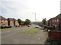
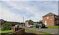
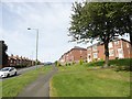
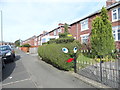
Photos of DH9 0XQ

Area Information
Living in DH9 0XQ means being part of a small, tightly knit residential cluster in England, home to 1,822 residents. This postcode area is characterised by its compact size and focus on established housing, with a median age of 47 and a population skewed toward adults aged 30–64. The community is predominantly White, with a strong emphasis on home ownership—56% of residents own their homes. Daily life here is shaped by proximity to local amenities, including retail outlets like Aldi and Morrisons, and rail access to nearby stations such as Bullion Lane and Chester. The area’s small footprint means it is ideal for those seeking a quieter, more stable environment, though its limited size also means residents must travel slightly to access broader services. The presence of two primary schools, St Joseph’s Roman Catholic Voluntary Aided Primary School and St Joseph’s Catholic Primary, underscores the area’s focus on family living. While the broadband and mobile connectivity scores are strong, the area’s safety profile includes a critical crime risk, which potential buyers should consider alongside its otherwise low environmental hazards.
- Area Type
- Postcode
- Area Size
- Not available
- Population
- 1822
- Population Density
- 2012 people/km²
The property market in DH9 0XQ is dominated by owner-occupied homes, with 56% of residents owning their properties. The accommodation type is primarily houses, which is typical for a small, residential postcode area. This suggests a market skewed toward long-term buyers rather than renters, though the limited data does not specify the proportion of rental properties. The small size of the area means the housing stock is likely to be tightly clustered, with limited new developments. For buyers, this implies a focus on established homes rather than speculative investment. The predominance of houses may appeal to families seeking space, but the compact nature of the postcode means buyers must consider proximity to larger towns for additional services. The lack of data on property prices or recent transactions leaves gaps in understanding the market’s dynamics, but the existing figures highlight a community-oriented, stable housing environment.
House Prices in DH9 0XQ
No properties found in this postcode.
Energy Efficiency in DH9 0XQ
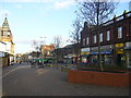
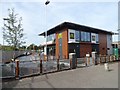
The lifestyle in DH9 0XQ is shaped by its proximity to retail and transport hubs. Nearby amenities include five retail outlets, such as Aldi Front and Morrisons Daily, offering everyday shopping convenience. The area’s rail stations, including Bullion Lane and Chester, provide access to broader networks, though the exact travel times to major destinations are not specified. The absence of parks or leisure facilities in the data suggests that residents may need to travel slightly for outdoor activities. The character of the area is defined by its small-scale amenities, which cater to daily needs without the bustle of larger towns. This makes DH9 0XQ suitable for those prioritising convenience over expansive leisure options. The mix of retail and transport options supports a practical, community-focused lifestyle, though the lack of detailed information on recreational spaces leaves some aspects of daily life unexplored.
Amenities
Schools
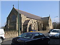
Residents of DH9 0XQ have access to two primary schools: St Joseph’s Roman Catholic Voluntary Aided Primary School and St Joseph’s Catholic Primary, both located in Stanley. These schools cater to younger children, providing a foundation for education within the area. While no Ofsted ratings are provided, the presence of two primary schools suggests a focus on early education, which is critical for families. The absence of secondary schools means students will need to travel to nearby towns for further education, a factor to consider for parents. The concentration of primary schools reflects the area’s role as a residential hub for families, though the lack of higher education facilities nearby may influence long-term decisions about living in DH9 0XQ.
| Rank | School | Type | Entry gender | Ages |
|---|
Explore more schools in this area
Go to Schools tabDemographics
DH9 0XQ has a median age of 47, with the majority of residents falling within the 30–64 age range. This suggests a community of established adults, many of whom may be in their prime working years or nearing retirement. Home ownership is prevalent, with 56% of properties owned by their occupants, indicating a stable, long-term resident base. The accommodation type is predominantly houses, which aligns with the area’s small, residential character. The predominant ethnic group is White, though no specific data on diversity or deprivation levels is provided. The age profile and home ownership figures suggest a relatively low turnover of residents, contributing to a sense of continuity. However, the absence of data on deprivation or socioeconomic status means the full picture of quality of life remains incomplete. The demographic makeup supports a community focused on family living, with schools and local amenities playing central roles in daily life.
Household Size
Accommodation Type
Tenure
Ethnic Group
Religion
Household Composition
Age
Household Deprivation
NS-SEC
Explore more demographic insights in this area
Go to Demographics tabPlanning
Planning Constraints
- Flood RiskPremium
- Ramsar Wetland SitesPremium
- Area of Outstanding Natural BeautyPremium
- Protected Nature ReservePremium
- Protected WoodlandPremium