Area Overview for DH9 0PU
Photos of DH9 0PU
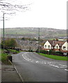
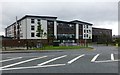
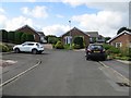
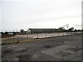
17 photos from this area
Area Information
Key information about the DH9 0PU including its size, population, and administrative classification.
- Area Type
- Postcode
- Area Size
- 2.5 hectares
- Population
- 1735
- Population Density
- 3638 people/km²
House Prices in DH9 0PU
54
Properties
£184,818
Average Sold Price
£115,000
Lowest Price
£315,000
Highest Price
Showing 54 properties
| Address | Type | Beds | Baths | Last Sale Price | Last Sale Date | |
|---|---|---|---|---|---|---|
| 67 Murray Park, Stanley, DH9 0PU | Detached | 5 | 3 | £315,000 | Dec 2025 | |
| 69 Murray Park, Stanley, DH9 0PU | house | - | - | £115,000 | Nov 2025 | |
| 97 Murray Park, Stanley, DH9 0PU | Terraced | 3 | 2 | £187,500 | Oct 2025 | |
| 74 Murray Park, Stanley, DH9 0PU | Semi-detached | 5 | 3 | £268,000 | Jul 2025 | |
| 106 Murray Park, Stanley, DH9 0PU | Semi-detached | 4 | 3 | £210,000 | Feb 2025 | |
| 89 Murray Park, Stanley, DH9 0PU | Detached | 4 | 3 | £253,500 | Sep 2024 | |
| 88 Murray Park, Stanley, DH9 0PU | Detached | 3 | 2 | £166,000 | Nov 2023 | |
| 63 Murray Park, Stanley, DH9 0PU | Detached | 4 | 4 | £275,000 | Mar 2023 | |
| 76 Murray Park, Stanley, DH9 0PU | Detached | 6 | 4 | £310,000 | Feb 2023 | |
| 85 Murray Park, Stanley, DH9 0PU | Semi-detached | 4 | 2 | £184,950 | Dec 2022 |
Page 1 of 6
Energy Efficiency in DH9 0PU
Amenities
Schools
| Rank | School | Type | Entry gender | Ages |
|---|
Explore more schools in this area
Go to Schools tabDemographics
Household Size
Two person
most common
Accommodation Type
Houses
most common
Tenure
58
majority
Ethnic Group
White
most common
Religion
N/A
most common
Household Composition
N/A
most common
Age
47
median
Adults (30-64 years)
most common
Household Deprivation
N/A
with no deprivation
NS-SEC
23
in Lower managerial occupations
Explore more demographic insights in this area
Go to Demographics tabPlanning
Planning Constraints
- Flood RiskPremium
- Ramsar Wetland SitesPremium
- Area of Outstanding Natural BeautyPremium
- Protected Nature ReservePremium
- Protected WoodlandPremium