Area Overview for DH9 0AS
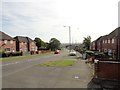
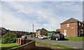
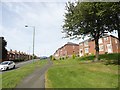
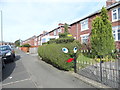
Photos of DH9 0AS

Area Information
DH9 0AS is a small, residential postcode area in England with a population of 1822, reflecting a compact community feel. The area is characterised by a predominance of houses, suggesting a mix of family homes and established properties. Daily life here is shaped by proximity to local amenities, including retail outlets like Aldi and Morrisons, and rail links to nearby stations such as Bullion Lane and Chester. The median age of 47 indicates a mature population, with adults aged 30–64 forming the largest demographic group. While the area lacks large-scale infrastructure, its small size fosters a close-knit environment. However, residents should be aware of the high crime risk, which is above average. For those seeking a quiet, residential setting with access to basic services, DH9 0AS offers a straightforward, if modest, lifestyle. The absence of protected natural sites or flood risks means the area is free from environmental constraints, though its limited size may restrict options for expansion or development.
- Area Type
- Postcode
- Area Size
- Not available
- Population
- 1822
- Population Density
- 2012 people/km²
The property market in DH9 0AS is dominated by houses, with 56% of residents owning their homes. This suggests a relatively stable market with limited rental activity, though the small size of the area means the housing stock is not extensive. The predominance of houses indicates a focus on family homes, which may appeal to buyers seeking larger living spaces. However, the limited number of properties means competition could be fierce for available homes. Buyers should consider the surrounding areas for broader options, as the immediate vicinity of DH9 0AS may have fewer properties. The home ownership rate also implies that a significant portion of the population has long-term ties to the area, which could influence property values and demand. For those prioritising a residential, family-friendly setting, the market offers a straightforward, if limited, selection of homes.
House Prices in DH9 0AS
No properties found in this postcode.
Energy Efficiency in DH9 0AS
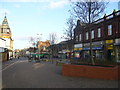
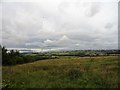
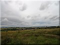
The lifestyle in DH9 0AS is defined by its small-scale amenities and proximity to essential services. Retail options include five nearby shops, with notable venues such as Aldi Front, Heron Stanley, and Morrisons Daily Stanley 4–6, providing access to groceries and daily necessities. The rail links to Bullion Lane and Chester enhance connectivity, enabling residents to travel to larger towns for additional shopping, dining, or leisure opportunities. While the area itself lacks large parks or recreational facilities, the absence of planning constraints such as protected woodlands or AONBs suggests open space may be available nearby. The combination of local retail and rail access creates a functional, if modest, lifestyle, where residents can meet daily needs without frequent travel. However, the limited range of amenities means those seeking a vibrant social or cultural scene may need to look beyond the immediate area.
Amenities
Schools
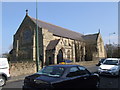
Residents of DH9 0AS have access to two primary schools within the area: St Joseph’s Roman Catholic Voluntary Aided Primary School and St Joseph’s Catholic Primary, both located in Stanley. These institutions cater to younger children, though no Ofsted ratings or specific educational outcomes are provided. The presence of two primary schools suggests a focus on early education, potentially serving the needs of local families. However, the absence of secondary schools or further education facilities means students may need to travel to nearby towns for higher-level schooling. The dual availability of Catholic schools may indicate a preference for faith-based education, though the exact differences in curriculum or facilities between the two schools are not specified. Families should consider the proximity of these schools when evaluating the area’s suitability for their children’s education.
| Rank | School | Type | Entry gender | Ages |
|---|
Explore more schools in this area
Go to Schools tabDemographics
The community in DH9 0AS is predominantly composed of adults aged 30–64, with a median age of 47. Home ownership stands at 56%, indicating a balance between owner-occupied properties and rental homes. The accommodation type is primarily houses, which aligns with the age profile of a family-oriented population. The predominant ethnic group is White, though no specific data on diversity or deprivation levels is provided. The high home ownership rate suggests a stable, long-term resident base, while the absence of detailed diversity metrics means the area’s social composition remains less defined. The age distribution implies a focus on established households, with fewer younger families or retirees compared to other regions. This demographic structure influences local services, with schools and amenities tailored to adult needs rather than younger children or elderly populations.
Household Size
Accommodation Type
Tenure
Ethnic Group
Religion
Household Composition
Age
Household Deprivation
NS-SEC
Explore more demographic insights in this area
Go to Demographics tabPlanning
Planning Constraints
- Flood RiskPremium
- Ramsar Wetland SitesPremium
- Area of Outstanding Natural BeautyPremium
- Protected Nature ReservePremium
- Protected WoodlandPremium