Area Overview for DH8 9AJ
Photos of DH8 9AJ
Area Information
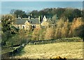
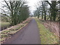
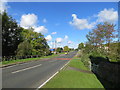
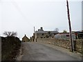
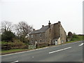
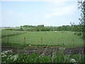
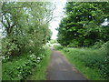
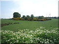
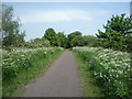
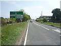
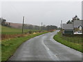
Living in DH8 9AJ offers a quiet, low-density lifestyle in a small residential cluster. With a population of 1,643 spread across 26 people per square kilometre, the area feels uncluttered and community-focused. The postcode covers a compact neighbourhood where daily life is shaped by proximity to local amenities and a strong sense of stability. Residents benefit from low crime rates, with a safety score of 81 out of 100, and no significant environmental risks such as flood zones or protected natural areas. The area’s appeal lies in its balance of practicality and peace, making it suitable for those seeking a slower pace without sacrificing access to essential services. Nearby, retail options like Tesco Consett and Morrisons provide convenience, while the presence of Castleside Primary School ensures families have a nearby educational foundation. For buyers, DH8 9AJ represents a small but functional community with a focus on long-term living rather than transient urban dynamics.
- Area Type
- Postcode
- Area Size
- Not available
- Population
- 1643
- Population Density
- 26 people/km²
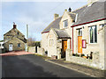
The property market in DH8 9AJ is dominated by owner-occupied homes, with 83% of residents owning their properties. This high rate of home ownership suggests a community prioritising long-term investment over rental living. The accommodation type is primarily houses, which is typical for smaller, low-density areas. This housing stock likely includes a mix of family homes and larger properties, reflecting the area’s demographic of adults aged 30-64. For buyers, the limited size of the postcode area means the housing stock is finite, with fewer options compared to larger urban centres. The focus on houses rather than flats or apartments may appeal to those seeking space and privacy. However, the small scale of the area also means that property availability is constrained, potentially limiting competition for buyers looking to enter the market.
House Prices in DH8 9AJ
No properties found in this postcode.
Energy Efficiency in DH8 9AJ
The lifestyle in DH8 9AJ is shaped by its proximity to retail and everyday amenities. Within practical reach are five retail venues, including Tesco Consett, Morrisons, and Aldi, providing convenience for grocery shopping and daily errands. These stores cater to a range of needs, from household essentials to specialty items. The area’s small size means that residents can access these amenities without long commutes, fostering a self-contained community feel. While the data does not mention parks or leisure facilities, the presence of multiple retail options suggests a focus on practical living. The combination of local shops and a low-density environment creates a relaxed, community-oriented atmosphere where daily life is centered around nearby services.
Amenities
Schools
The nearest school to DH8 9AJ is Castleside Primary School, which serves the local community with primary education. While no secondary schools are listed in the data, the presence of a primary school ensures that families with younger children have a nearby educational option. The school’s type and Ofsted rating are not specified, but its proximity suggests it is a key local institution. For families requiring secondary education, residents may need to travel to nearby towns or postcode areas. The availability of a primary school contributes to the area’s appeal for households with children, though the absence of higher-tier schools could be a consideration for those planning long-term family needs.
| Rank | School | Type | Entry gender | Ages |
|---|
Explore more schools in this area
Go to Schools tabDemographics
DH8 9AJ has a median age of 47, with the majority of residents falling into the 30-64 age range. This suggests a mature, stable community where most households are likely to be established or nearing retirement. Home ownership is high at 83%, indicating a strong preference for long-term residency over rental properties. The area is predominantly composed of houses, reflecting a less densely populated, suburban character. The predominant ethnic group is White, which aligns with the broader demographic patterns of the region. While specific data on deprivation is not provided, the high home ownership rate and low crime score imply a relatively secure and self-sufficient environment. This demographic profile suggests a community focused on stability, with fewer transient populations and a lower demand for short-term rental properties.
Household Size
Accommodation Type
Tenure
Ethnic Group
Religion
Household Composition
Age
Household Deprivation
NS-SEC
Explore more demographic insights in this area
Go to Demographics tabPlanning
Planning Constraints
- Flood RiskPremium
- Ramsar Wetland SitesPremium
- Area of Outstanding Natural BeautyPremium
- Protected Nature ReservePremium
- Protected WoodlandPremium