Area Overview for DH8 8TH
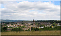
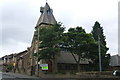
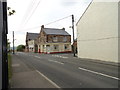
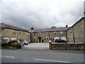
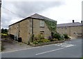
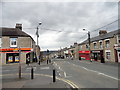
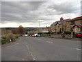
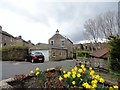
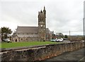
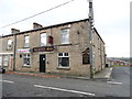
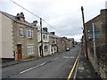
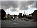
Photos of DH8 8TH
Area Information
Living in DH8 8TH means locating yourself within a compact residential cluster defined by the specific postcode covering this site. This small area spans just 9083 square metres, making it one of the most densely populated pockets in the region despite its limited physical footprint. You will find that almost 175,000 people live per square kilometre in this zone, creating an exceptionally tight-knit environment. The population stands at 1590 residents, who navigate their daily lives in close proximity to one another. Residents here experience a neighbourhood where distance between homes is negligible, fostering a sense of immediate community. The surroundings are characterised by this high density, which dictates how local interactions unfold and how resources are shared. Your daily routine in DH8 8TH is shaped by the fact that you are surrounded by a significant number of neighbours in a very small geographic space. This configuration offers convenience but also implies a lack of open space within the immediate boundaries. Homes in this postcode share the reality of dense living, where every square metre carries weight. The area functions as a focused residential hub, concentrating the lives of over a thousand individuals into a defined square kilometre. For those considering a move, understanding this scale is essential to grasping the reality of daily life in DH8 8TH.
- Area Type
- Postcode
- Area Size
- 9083 m²
- Population
- 1590
- Population Density
- 3488 people/km²
The property market in DH8 8TH presents a clear picture of the housing stock available to buyers in this specific postcode. Accommodation is strictly limited to houses, with no flats or apartments recorded within this boundary. This singular type of housing defines the physical layout and garden space expectations for potential residents. Home ownership rates sit at exactly 51%, placing the area almost evenly between owner-occupiers and other housing tenures. This balance indicates a mix of long-term owners and smaller proportions of renters, which is typical for established residential clusters. The fact that the entire area consists of houses suggests that buyers looking for semi-detached, detached, or terrace styles will find the variety they need local to DH8 8TH. Prospective buyers should note that the total area size of 9083 square metres limits the total number of properties available compared to larger districts. The housing market here is small by definition, driven by the population count of 1590. This concentration means properties move with particular speed when they enter the market. The lack of alternative accommodation types means you cannot find a flat within this postcode, only houses. This constraint dictates your options if you are looking specifically for this area. The 51% ownership rate further confirms that a significant portion of the stock is occupied by non-buyers, potentially increasing competition for purchase. Homes in DH8 8TH therefore represent a specific and finite selection of the manor.
House Prices in DH8 8TH
Showing 24 properties
| Address | Type | Beds | Baths | Last Sale Price | Last Sale Date | |
|---|---|---|---|---|---|---|
| 22 Melrose Court, Blackhill, DH8 8TH | Terraced | 3 | 1 | £63,000 | Nov 2019 | |
| 18 Melrose Court, Blackhill, DH8 8TH | house | - | - | £95,000 | Dec 2015 | |
| 21 Melrose Court, Blackhill, DH8 8TH | house | 3 | - | £70,000 | Aug 2014 | |
| 14 Melrose Court, Blackhill, DH8 8TH | Terraced | - | - | £124,950 | Jul 2007 | |
| 3 Melrose Court, Blackhill, DH8 8TH | Bungalow | - | - | - | - | |
| 6 Melrose Court, Blackhill, DH8 8TH | Bungalow | - | - | - | - | |
| 13 Melrose Court, Blackhill, DH8 8TH | Terraced | - | - | - | - | |
| 17 Melrose Court, Blackhill, DH8 8TH | Terraced | - | - | - | - | |
| 24 Melrose Court, Blackhill, DH8 8TH | Semi-detached | - | - | - | - | |
| 2 Melrose Court, Blackhill, DH8 8TH | Bungalow | - | - | - | - |
Energy Efficiency in DH8 8TH
Residents of DH8 8TH have access to practical amenities within easy reach for their daily needs. The nearest retail options include Tesco Consett, which serves as a primary shopping destination. You will also find another Tesco Consett location within the practical reach of your home. Heron Number is available as a third retail outlet close to this postcode. These three locations provide the essential shopping services required for a typical household life. While the area is small, these nearby venues ensure you do not need to travel far for groceries or daily necessities. The concentration of Tesco locations highlights the commercial focus required by the local population. Dining, parks, and leisure facilities are not explicitly detailed in the provided data, so your choices rely on these main retail anchors. Living in DH8 8TH means your lifestyle revolves around the convenience of having Tesco Consett and Heron Number nearby. You can plan your weekly shop without spending excessive time on travel. The presence of multiple Tesco branches suggests a well-serviced area despite the small postcode size. These amenities form the backbone of your daily routine when you call this location your home. The retail availability ensures that basic needs are met without requiring long commutes.
Amenities
Schools
Education options for families residing in DH8 8TH are located nearby, providing immediate access to local schooling. The nearest institutions are all primary schools, which aligns with the residential nature of this cluster. Blackhill Infant School serves as an early education provider for the local community. St Mary's Roman Catholic Voluntary Aided Primary School, Blackhill, offers a faith-based educational option close to your door. St Mary's RC Infant School provides early years education in the immediate neighbourhood. Benfieldside Junior School serves older primary-age children in the vicinity. St Mary's Catholic Primary School, Blackhill, completes the list of local primary education providers you can access. The presence of multiple primary schools indicates a strong local emphasis on early education. Parents in DH8 8TH will find that all these institutions fall under the primary category, meaning secondary education will require travel beyond this immediate postcode. The mix includes both infant and junior stages, alongside Catholic voluntary aided schools, which gives families a choice of denominational and structural approaches. Since the data lists only primary schools, you should plan for secondary education locations further afield. Schools near DH8 8TH are concentrated in the local area, ensuring short commutes for younger students. The availability of Blackhill Infant School and Benfieldside Junior School specifically supports local children's development without long-distance travel.
| Rank | School | Type | Entry gender | Ages |
|---|
Explore more schools in this area
Go to Schools tabDemographics
The community in DH8 8TH reflects a mature demographic profile dominated by adults between the ages of 30 and 64 years. The median age for residents here is 47, indicating a population that is well established in their working lives or approaching retirement. Home ownership levels stand at 51%, suggesting that slightly more than half of the households in this area belong to their residences. This ownership rate points towards a settled population rather than a transient rental market. The accommodation type is exclusively houses, which shapes the character of the street and the expectations of buyers looking for this specific property stock. You will not find flats or apartments within this postcode, only residential houses. The predominant ethnic group is White, which forms the central demographic identity of the local population. This homogeneity often correlates with the stability found in established neighbourhoods like DH8 8TH. While the area does not display a wide range of age diversity, the concentration of adults in their prime working and earning years creates a specific social dynamic. Families with grown children and empty nesters likely dominate the scene. These figures paint a picture of a stable, middle-aged community where long-term residents are the norm. The demographic blend suggests a quiet life centred on rather than high energy or rapid turnover. Understanding the 51% ownership and house-only stock helps you visualise the actual homes in DH8 8TH.
Household Size
Accommodation Type
Tenure
Ethnic Group
Religion
Household Composition
Age
Household Deprivation
NS-SEC
Explore more demographic insights in this area
Go to Demographics tabPlanning
Planning Constraints
- Flood RiskPremium
- Ramsar Wetland SitesPremium
- Area of Outstanding Natural BeautyPremium
- Protected Nature ReservePremium
- Protected WoodlandPremium