Area Overview for DH7 8QG
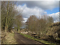
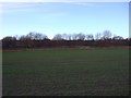
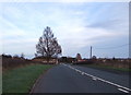
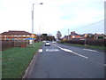
Photos of DH7 8QG

Area Information
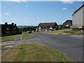
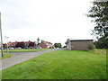
Living in DH7 8QG means residing in a tightly defined residential cluster covering just 6342 square metres. This specific postcode area accommodates a population of 1430 people, resulting in an exceptionally high population density of 225,467 people per square kilometre. The environment is built around a mix of houses that serve as the primary accommodation type for the community. Daily life here is characterised by proximity, where neighbours are invariably close by within a defined small footprint. The area represents a concentrated living experience rather than a sprawling suburb. You are part of a group where the distance between homes is minimal, creating an intimate sense of community within a larger administrative boundary. The layout supports residents who prefer convenience over open space. Understanding the scale is essential when considering homes in DH7 8QG. The sheer density dictates a different lifestyle compared to less crowded postcodes. Every square metre of this area is utilised for housing, meaning there is little room for varied land use. The character of the neighbourhood is shaped by this compact nature, where street life and public interactions likely occur frequently due to the closeness of dwellings. Prospective buyers must consider whether they thrive in such a condensed environment before committing to a property here.
- Area Type
- Postcode
- Area Size
- 6342 m²
- Population
- 1430
- Population Density
- 3126 people/km²
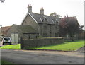
The housing stock for homes in DH7 8QG is defined by a predominance of houses. This contrasts with flats or bungalows that might characterise other parts of the local district. The mode of ownership presents a clear divide between owners and tenants. Currently, 39% of residents own their homes, leaving 61% as renters. This balance indicates a hybrid market where investment and rental opportunities coexist. For buyers, the presence of owner-occupied properties suggests a degree of long-term commitment from residents. However, the higher proportion of rented homes implies significant potential for tenant turnover or a robust letting market. The small area size of 6342 square metres means supply is extremely limited. Competition for existing stocks could be fierce given the constrained physical geography. The type of accommodation influences the value proposition for families seeking space versus investors looking for yields. Understanding this split is vital when viewing properties in this postcode. The market dynamics are driven by the specific constraint of available land. Buyers should assess whether purchasing in such a dense cluster aligns with their long-term residential goals. The mix of owner and renter households creates a dynamic environment where property values may react strongly to broader market shifts.
House Prices in DH7 8QG
Showing 1 properties
| Address | Type | Beds | Baths | Last Sale Price | Last Sale Date | |
|---|---|---|---|---|---|---|
| Family Centre, Brandon Community Primary School, Carr Avenue, Brandon, DH7 8QG | commercial | - | - | - | - |
Energy Efficiency in DH7 8QG
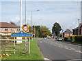
Daily life in DH7 8QG benefits from convenient access to key retail and transport nodes within practical reach. For your weekly shopping, Co-op Brandon and Lidl Brandon are available nearby, providing essential grocery options. Tesco Langley serves as another major retail destination for residents who prefer larger supermarket facilities. Alongside these stores, Durham Railway Station connects the area to the wider transport network, offering easy access to regional centres. These amenities within reasonable distance ensure that residents can manage daily errands without extensive travel. The availability of five notable retail sites enhances the convenience factor for families and individuals. You can expect a balanced lifestyle where essential goods and services are accessible. Dining and leisure options are not explicitly detailed in the provided immediate amenities, but the proximity to major stations and supermarkets forms the backbone of local convenience. The character of the area is defined by functional accessibility rather than leisure-focused destinations. Living in this postcode means having your daily necessities close by. The presence of Co-op, Lidl, and Tesco structures the social rhythm of the neighbourhood. Public access to rail at Durham Railway Station complements the retail convenience.
Amenities
Schools
Education options for families in DH7 8QG are anchored by primary institutions. In the immediate vicinity, you will find Brandon Junior School, which provides primary education. Nearby is Brandon Infants' School, catering to the younger foundational years. Brandon Primary School also operates within reach of residents. For students requiring further primary education, Brandon Primary Academy is available. This specific academy holds a good Ofsted rating, offering a concrete standard of quality assurance. The concentration of schools sharing the Brandon name indicates a dedicated educational hub in the broader neighbourhood. This mix allows children to access facilities without travelling far outside the local umbrella. Families with young children will find the density of primary options convenient for daily schooling needs. The presence of a rated academy provides reassurance regarding the standard of instruction. Parents considering schools near DH7 8QG have access to multiple primary choices. The education landscape supports the demographic focus on adults aged thirty to sixty-four, many of whom have school-aged children or young families. Having several primary schools locally means shorter commutes for parents. You can expect a range of primary education experiences within a short distance of your home.
| Rank | School | Type | Entry gender | Ages |
|---|
Explore more schools in this area
Go to Schools tabDemographics
The community in DH7 8QG is dominated by adults, with the median age standing at 47 years. Most residents fall into the thirty to sixty-four age range, indicating a population consisting largely of established families or individuals in mid-career phases. Home ownership stands at 39%, meaning slightly less than two-thirds of households rent their accommodation. This figure suggests a significant portion of the community relies on the private rental market. The predominant ethnic group is White, reflecting the demographic makeup typical of many established residential clusters. Accommodation consists mainly of houses, aligning with the family-centred profile of the median age. The absence of data regarding income or deprivation means focusing on the structural composition of the household. The high median age influences local services and demand for facilities catering to adults and older children. For those moving to the area, the demographic profile suggests a stable, mature community rather than a volatile student or transient zone. The thirty to sixty-four age bracket likely drives the need for reliable transport links and quality housing. You will find a population that views the area as a settled home rather than a temporary base. These statistics paint a picture of a demographic profile that values stability and practicality in their living environment.
Household Size
Accommodation Type
Tenure
Ethnic Group
Religion
Household Composition
Age
Household Deprivation
NS-SEC
Explore more demographic insights in this area
Go to Demographics tabPlanning
Planning Constraints
- Flood RiskPremium
- Ramsar Wetland SitesPremium
- Area of Outstanding Natural BeautyPremium
- Protected Nature ReservePremium
- Protected WoodlandPremium