Area Overview for DH7 7EJ
Photos of DH7 7EJ
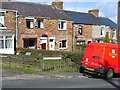
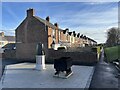
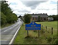
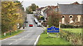
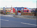
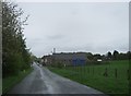
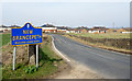
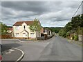
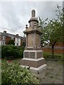
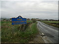
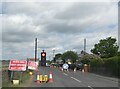
11 photos from this area
Area Information
Key information about the DH7 7EJ including its size, population, and administrative classification.
- Area Type
- Postcode
- Area Size
- 3971 m²
- Population
- 1464
- Population Density
- 215 people/km²
House Prices in DH7 7EJ
30
Properties
£45,644
Average Sold Price
£11,000
Lowest Price
£80,000
Highest Price
Showing 30 properties
| Address | Type | Beds | Baths | Last Sale Price | Last Sale Date | |
|---|---|---|---|---|---|---|
| 24 Prospect Terrace, New Brancepeth, DH7 7EJ | house | 3 | - | £29,000 | May 2025 | |
| 3 Prospect Terrace, New Brancepeth, DH7 7EJ | house | - | - | £35,000 | May 2025 | |
| 8 Prospect Terrace, New Brancepeth, DH7 7EJ | Terraced | 3 | 1 | £45,500 | Apr 2025 | |
| 4 Prospect Terrace, New Brancepeth, DH7 7EJ | Terraced | 2 | 1 | £56,000 | Nov 2023 | |
| 6 Prospect Terrace, New Brancepeth, DH7 7EJ | Terraced | 2 | 1 | £59,000 | Apr 2023 | |
| 22 Prospect Terrace, New Brancepeth, DH7 7EJ | Terraced | 2 | 1 | £26,000 | Nov 2022 | |
| 5 Prospect Terrace, New Brancepeth, DH7 7EJ | Terraced | 2 | 1 | £75,000 | Oct 2022 | |
| 10 Prospect Terrace, New Brancepeth, DH7 7EJ | Terraced | 2 | 1 | £53,000 | Nov 2021 | |
| 21 Prospect Terrace, New Brancepeth, DH7 7EJ | house | - | - | £65,000 | Jul 2021 | |
| 25 Prospect Terrace, New Brancepeth, DH7 7EJ | house | - | - | £60,000 | Jul 2021 |
Page 1 of 3
Energy Efficiency in DH7 7EJ
Amenities
Schools
| Rank | School | Type | Entry gender | Ages |
|---|
Explore more schools in this area
Go to Schools tabDemographics
Household Size
One person
most common
Accommodation Type
Houses
most common
Tenure
51
majority
Ethnic Group
White
most common
Religion
N/A
most common
Household Composition
N/A
most common
Age
47
median
Adults (30-64 years)
most common
Household Deprivation
N/A
with no deprivation
NS-SEC
20
in Lower managerial occupations
Explore more demographic insights in this area
Go to Demographics tabPlanning
Planning Constraints
- Flood RiskPremium
- Ramsar Wetland SitesPremium
- Area of Outstanding Natural BeautyPremium
- Protected Nature ReservePremium
- Protected WoodlandPremium