Area Overview for DH7 0YT
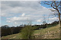
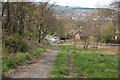
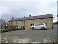
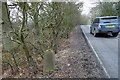
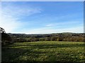
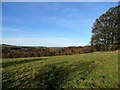
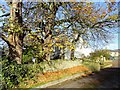
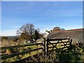
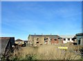
Photos of DH7 0YT


Area Information
Living in DH7 0YT means being part of a tightly knit residential cluster in England, where 1,390 people reside across a densely populated area of 1271 people per square kilometre. This small postcode area is characterised by its compact nature, with homes primarily occupied by owners rather than renters. The community feels close-knit, with daily life shaped by proximity to local amenities and schools. While the area lacks large-scale infrastructure, its practical reach includes essential retail outlets and educational institutions. DH7 0YT is not a sprawling suburb but a focused cluster, ideal for those seeking a quieter, more manageable environment. The presence of schools like St Bede’s Catholic School and Lanchester Nursery School suggests a family-oriented demographic, with adults aged 30–64 forming the majority. For buyers, this area offers a snapshot of rural England’s charm, balanced with the practicalities of modern living. Its low crime risk and absence of environmental constraints make it a stable choice for those prioritising safety and simplicity.
- Area Type
- Postcode
- Area Size
- Not available
- Population
- 1390
- Population Density
- 1271 people/km²
DH7 0YT’s property market is dominated by owner-occupied homes, with 65% of residences owned by their occupants. The accommodation type is primarily houses, which is unusual for a small postcode area but suggests a mix of larger properties and perhaps some semi-detached or detached homes. This contrasts with areas where flats or rental properties predominate. The high home ownership rate indicates a community of long-term residents rather than a transient rental market. Buyers should consider that the area’s small size means housing stock is limited, and properties may be in high demand due to the absence of major environmental constraints. The focus on houses also implies that the area may cater to families seeking more space than a typical urban setting. However, the compact nature of DH7 0YT means that property availability is likely constrained, and buyers may need to look beyond immediate surroundings for larger options.
House Prices in DH7 0YT
No properties found in this postcode.
Energy Efficiency in DH7 0YT
The lifestyle in DH7 0YT is shaped by its proximity to essential retail outlets, including Spar, Tesco Stanley, and Co-op Quebec. These stores provide everyday necessities, reducing the need for long trips to larger centres. While the area lacks dining options or leisure facilities, the retail presence ensures convenience for shopping and household needs. The compact nature of the postcode means that amenities are within practical reach, though the absence of parks or recreational spaces may limit opportunities for outdoor activities. The community’s character is defined by its small-scale retail and educational hubs, creating a self-contained environment. For residents, this balance of practicality and proximity to schools and shops supports a quiet, functional lifestyle.
Amenities
Schools
The schools near DH7 0YT include Lanchester Nursery School, which provides early education, and St Bede’s Catholic Comprehensive School and Sixth Form College, Lanchester, offering primary and secondary education. A third institution, St Bede’s Catholic School and Sixth Form College, Lanchester, is an academy with an Ofsted rating of satisfactory. This mix of nursery, primary, and academy schools suggests a comprehensive educational offering for families. The presence of a Catholic school may appeal to those seeking faith-based education, while the academy’s rating indicates a moderate standard of teaching. For parents, the proximity of multiple schools within walking distance reduces the need for long commutes, reinforcing the area’s family-friendly appeal. The absence of independent or grammar schools, however, means that educational choices are limited to state-run institutions.
| Rank | School | Type | Entry gender | Ages |
|---|
Explore more schools in this area
Go to Schools tabDemographics
The population of DH7 0YT skews towards adults aged 30–64, with a median age of 47. This suggests a community of established professionals and families, rather than a younger or retired demographic. Home ownership is high at 65%, indicating a strong presence of long-term residents. The accommodation type is predominantly houses, which aligns with the area’s low population density and compact layout. The predominant ethnic group is White, though no specific data on diversity or deprivation is provided. The absence of detailed diversity metrics means the community’s composition remains largely unquantified. However, the age profile and ownership rates imply a stable, middle-aged population with a focus on family living. This demographic likely values the area’s safety, proximity to schools, and the absence of environmental restrictions that could complicate property ownership.
Household Size
Accommodation Type
Tenure
Ethnic Group
Religion
Household Composition
Age
Household Deprivation
NS-SEC
Explore more demographic insights in this area
Go to Demographics tabPlanning
Planning Constraints
- Flood RiskPremium
- Ramsar Wetland SitesPremium
- Area of Outstanding Natural BeautyPremium
- Protected Nature ReservePremium
- Protected WoodlandPremium