Area Overview for DH6 5DY
Photos of DH6 5DY
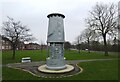

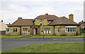
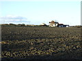
22 photos from this area
Area Information
Key information about the DH6 5DY including its size, population, and administrative classification.
- Area Type
- Postcode
- Area Size
- 1.2 hectares
- Population
- 1459
- Population Density
- 4187 people/km²
House Prices in DH6 5DY
32
Properties
£77,500
Average Sold Price
£56,000
Lowest Price
£122,500
Highest Price
Showing 32 properties
| Address | Type | Beds | Baths | Last Sale Price | Last Sale Date | |
|---|---|---|---|---|---|---|
| 8 William Street, Bowburn, DH6 5DY | Semi-detached | 3 | 1 | £122,500 | Jul 2024 | |
| 10 William Street, Bowburn, DH6 5DY | Semi-detached | - | - | £90,000 | Aug 2023 | |
| 17 William Street, Bowburn, DH6 5DY | house | - | - | £97,000 | Mar 2023 | |
| 19 William Street, Bowburn, DH6 5DY | house | - | - | £70,000 | May 2021 | |
| 13 William Street, Bowburn, DH6 5DY | house | - | - | £56,000 | Mar 2021 | |
| 20 William Street, Bowburn, DH6 5DY | house | - | - | £65,000 | Oct 2019 | |
| 12 William Street, Bowburn, DH6 5DY | house | - | - | £75,000 | May 2019 | |
| 16 William Street, Bowburn, DH6 5DY | Semi-detached | 3 | 1 | £72,000 | Jun 2017 | |
| 2 William Street, Bowburn, DH6 5DY | Semi-detached | 3 | 1 | £60,000 | May 2013 | |
| 29 William Street, Bowburn, DH6 5DY | Semi-detached | 2 | 1 | £63,000 | Apr 2010 |
Page 1 of 4
Energy Efficiency in DH6 5DY
Amenities
Schools
| Rank | School | Type | Entry gender | Ages |
|---|
Explore more schools in this area
Go to Schools tabDemographics
Household Size
One person
most common
Accommodation Type
Houses
most common
Tenure
49
majority
Ethnic Group
White
most common
Religion
N/A
most common
Household Composition
N/A
most common
Age
47
median
Adults (30-64 years)
most common
Household Deprivation
N/A
with no deprivation
NS-SEC
21
in Lower managerial occupations
Explore more demographic insights in this area
Go to Demographics tabPlanning
Planning Constraints
- Flood RiskPremium
- Ramsar Wetland SitesPremium
- Area of Outstanding Natural BeautyPremium
- Protected Nature ReservePremium
- Protected WoodlandPremium