Area Overview for DH6 3LP
Photos of DH6 3LP
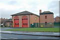
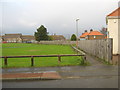
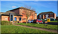
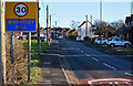
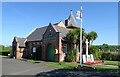
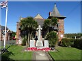
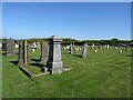
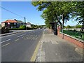
15 photos from this area
Area Information
Key information about the DH6 3LP including its size, population, and administrative classification.
- Area Type
- Postcode
- Area Size
- 5569 m²
- Population
- 1698
- Population Density
- 389 people/km²
House Prices in DH6 3LP
7
Properties
£750,000
Average Sold Price
£750,000
Lowest Price
£750,000
Highest Price
Showing 7 properties
| Address | Type | Beds | Baths | Last Sale Price | Last Sale Date | |
|---|---|---|---|---|---|---|
| Abbots Court Care Home, Wingate Lane, Wheatley Hill, DH6 3LP | hospital_care_home | - | - | £750,000 | Mar 2016 | |
| Flat, 1 Wingate Lane, Wheatley Hill, DH6 3LP | Retail | - | - | - | - | |
| Highfield Care Home, Wellfield House, Wingate Lane, Wheatley Hill, DH6 3LP | Retirement | - | - | - | - | |
| Sunhill House, Wingate Lane, Wheatley Hill, DH6 3LP | Detached | - | - | - | - | |
| Meadowbrook Cottage, Wingate Lane, Wheatley Hill, DH6 3LP | Detached | - | - | - | - | |
| Independent Distribution Network Operator, Wingate Lane, Wheatley Hill, DH6 3LP | commercial | - | - | - | - | |
| Wellfield House, Wingate Lane, Wheatley Hill, DH6 3LP | Detached | - | - | - | - |
Energy Efficiency in DH6 3LP
Amenities
Schools
| Rank | School | Type | Entry gender | Ages |
|---|
Explore more schools in this area
Go to Schools tabDemographics
Household Size
Two person
most common
Accommodation Type
Houses
most common
Tenure
64
majority
Ethnic Group
White
most common
Religion
N/A
most common
Household Composition
N/A
most common
Age
47
median
Adults (30-64 years)
most common
Household Deprivation
N/A
with no deprivation
NS-SEC
23
in Lower managerial occupations
Explore more demographic insights in this area
Go to Demographics tabPlanning
Planning Constraints
- Flood RiskPremium
- Ramsar Wetland SitesPremium
- Area of Outstanding Natural BeautyPremium
- Protected Nature ReservePremium
- Protected WoodlandPremium