Area Overview for DH6 2PX
Photos of DH6 2PX
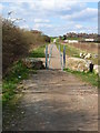
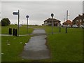
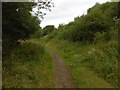
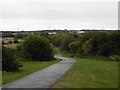


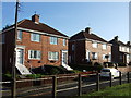

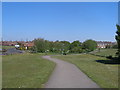
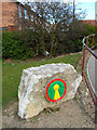
10 photos from this area
Area Information
Key information about the DH6 2PX including its size, population, and administrative classification.
- Area Type
- Postcode
- Area Size
- 9.3 hectares
- Population
- 1385
- Population Density
- 2619 people/km²
House Prices in DH6 2PX
41
Properties
£94,954
Average Sold Price
£26,000
Lowest Price
£220,000
Highest Price
Showing 41 properties
| Address | Type | Beds | Baths | Last Sale Price | Last Sale Date | |
|---|---|---|---|---|---|---|
| Cleveland House, 31 Dixon Estate, Shotton Colliery, DH6 2PX | Semi-detached | 2 | 1 | £140,000 | Dec 2024 | |
| North Lea, 18 Dixon Estate, Shotton Colliery, DH6 2PX | Semi-detached | 2 | - | £135,000 | Nov 2024 | |
| Hazel Hurst, 37 Dixon Estate, Shotton Colliery, DH6 2PX | Semi-detached | 2 | 1 | £75,000 | Dec 2022 | |
| Montrose, 29 Dixon Estate, Shotton Colliery, DH6 2PX | Semi-detached | 2 | 1 | £122,000 | Aug 2022 | |
| 11 Dixon Estate, Shotton Colliery, DH6 2PX | Semi-detached | 2 | - | £125,000 | Jul 2022 | |
| 14 Dixon Estate, Shotton Colliery, DH6 2PX | Semi-detached | 2 | 1 | £80,000 | Aug 2021 | |
| Moorside, 24 Dixon Estate, Shotton Colliery, DH6 2PX | Semi-detached | 2 | 1 | £72,000 | Feb 2020 | |
| Glenavoo, 35 Dixon Estate, Shotton Colliery, DH6 2PX | Detached | 3 | 1 | £93,000 | Mar 2019 | |
| Allandale, 25 Dixon Estate, Shotton Colliery, DH6 2PX | house | 2 | - | £62,000 | Nov 2017 | |
| 6 Dixon Estate, Shotton Colliery, DH6 2PX | Semi-detached | 2 | - | £80,000 | Sep 2017 |
Page 1 of 5
Energy Efficiency in DH6 2PX
Amenities
Schools
| Rank | School | Type | Entry gender | Ages |
|---|
Explore more schools in this area
Go to Schools tabDemographics
Household Size
One person
most common
Accommodation Type
Houses
most common
Tenure
41
majority
Ethnic Group
White
most common
Religion
N/A
most common
Household Composition
N/A
most common
Age
47
median
Adults (30-64 years)
most common
Household Deprivation
N/A
with no deprivation
NS-SEC
15
in Lower managerial occupations
Explore more demographic insights in this area
Go to Demographics tabPlanning
Planning Constraints
- Flood RiskPremium
- Ramsar Wetland SitesPremium
- Area of Outstanding Natural BeautyPremium
- Protected Nature ReservePremium
- Protected WoodlandPremium