Area Overview for DH6 1LE
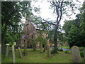
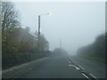
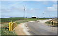
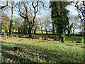
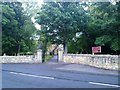
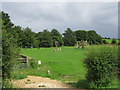
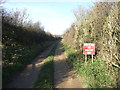
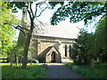
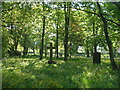
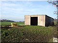
Photos of DH6 1LE
Area Information
Living in DH6 1LE means being part of a small, tightly knit residential cluster in England, where 2,207 people reside across a low-density area of 175 people per square kilometre. This postcode area is characterised by its focus on single-family homes, reflecting a community that values stability and space. Daily life here is shaped by proximity to essential services, including a railway station at Durham and a selection of retail outlets like Co-op Sherburn and Sainsburys Durham. The area’s appeal lies in its balance of quiet living with practical access to urban amenities. With a median age of 47 and a population skewed toward adults aged 30–64, DH6 1LE is a place where families and long-term residents coexist, often owning their homes. The absence of major environmental constraints, such as protected woodlands or flood zones, adds to its straightforward living experience. For those seeking a manageable, low-risk environment with clear infrastructure, this area offers a pragmatic alternative to denser urban settings.
- Area Type
- Postcode
- Area Size
- Not available
- Population
- 2207
- Population Density
- 175 people/km²
The property market in DH6 1LE is defined by its high home ownership rate of 60% and a focus on single-family homes. This suggests a market where owner-occupation is the norm, rather than rental properties. The prevalence of houses over flats indicates a preference for spacious, private living, which may appeal to families or those seeking long-term stability. Given the small size of the area, the housing stock is likely limited to a few dozen properties, making it a niche market for buyers prioritising ownership over investment. The lack of planning constraints or environmental restrictions, such as AONB or protected woodlands, means development pressures are minimal. For prospective buyers, this translates to a straightforward purchase process, though the limited inventory could mean competition for available homes. The area’s proximity to Durham’s amenities may also influence property values, offering a blend of residential tranquillity and urban accessibility.
House Prices in DH6 1LE
Showing 1 properties
| Address | Type | Beds | Baths | Last Sale Price | Last Sale Date | |
|---|---|---|---|---|---|---|
| Crime Rigg Farm Bungalow, Crime Rigg Bank, Shadforth, DH6 1LE | Detached | - | - | - | - |
Energy Efficiency in DH6 1LE
The lifestyle in DH6 1LE is shaped by its proximity to essential retail and transport links. Nearby shops include Co-op Sherburn, Budgens Thornley, and Sainsburys Durham, offering everyday convenience for groceries and household needs. The presence of a railway station at Durham adds connectivity, enabling access to larger towns and services. While the area lacks expansive parks or leisure facilities, the low population density suggests open spaces may be available for local use. The retail options provide a mix of local and national chains, catering to practical needs without the vibrancy of a bustling high street. For residents, the balance of nearby amenities and quiet living creates a functional, low-maintenance lifestyle.
Amenities
Schools
Residents of DH6 1LE have access to two primary schools: Ludworth Primary School, which holds a ‘good’ Ofsted rating, and Sherburn Hill Primary School. Both institutions cater to younger children, providing a foundation for early education within the community. The presence of two primary schools suggests a focus on family-friendly infrastructure, though the absence of secondary schools means students may need to travel to nearby areas for further education. Ludworth’s ‘good’ rating indicates a school delivering consistent standards in teaching and outcomes, while Sherburn Hill’s unspecified rating leaves room for potential variation in quality. For families prioritising proximity to educational institutions, the availability of two primary schools offers flexibility, though the lack of secondary options should be considered in long-term planning.
| Rank | School | Type | Entry gender | Ages |
|---|
Explore more schools in this area
Go to Schools tabDemographics
The community in DH6 1LE is predominantly composed of adults aged 30–64, with a median age of 47. This suggests a mature population, likely with established careers and family ties. Home ownership is high at 60%, indicating a stable housing market where most residents live in properties they own. The accommodation type is primarily houses, reflecting a preference for detached or semi-detached homes over flats. The predominant ethnic group is White, which aligns with broader regional trends. The absence of specific data on deprivation or diversity metrics means the area’s social fabric is not explicitly detailed, but the demographic profile points to a community focused on long-term residency and family life. With no significant youth or elderly population skew, DH6 1LE is a place where middle-aged residents form the core of daily interactions and local institutions.
Household Size
Accommodation Type
Tenure
Ethnic Group
Religion
Household Composition
Age
Household Deprivation
NS-SEC
Explore more demographic insights in this area
Go to Demographics tabPlanning
Planning Constraints
- Flood RiskPremium
- Ramsar Wetland SitesPremium
- Area of Outstanding Natural BeautyPremium
- Protected Nature ReservePremium
- Protected WoodlandPremium