Area Overview for DH5 9SF
Photos of DH5 9SF
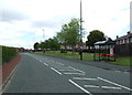
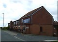
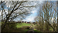
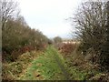
26 photos from this area
Area Information
Key information about the DH5 9SF including its size, population, and administrative classification.
- Area Type
- Postcode
- Area Size
- 1.1 hectares
- Population
- 1714
- Population Density
- 514 people/km²
House Prices in DH5 9SF
30
Properties
£128,316
Average Sold Price
£54,950
Lowest Price
£222,500
Highest Price
Showing 30 properties
| Address | Type | Beds | Baths | Last Sale Price | Last Sale Date | |
|---|---|---|---|---|---|---|
| 25 Bloomfield Drive, Houghton Le Spring, DH5 9SF | Detached | 4 | 2 | £185,000 | May 2025 | |
| 21 Bloomfield Drive, Houghton Le Spring, DH5 9SF | Semi-detached | 3 | 1 | £173,500 | Feb 2024 | |
| 1 Bloomfield Drive, Houghton Le Spring, DH5 9SF | house | 3 | 2 | £142,000 | Feb 2024 | |
| 17 Bloomfield Drive, Houghton Le Spring, DH5 9SF | Detached | 4 | 2 | £222,500 | Nov 2022 | |
| 8 Bloomfield Drive, Houghton Le Spring, DH5 9SF | house | - | - | £136,000 | Oct 2022 | |
| 14 Bloomfield Drive, Houghton Le Spring, DH5 9SF | house | - | - | £193,000 | May 2022 | |
| 3 Bloomfield Drive, Houghton Le Spring, DH5 9SF | house | - | - | £131,000 | Oct 2017 | |
| 18 Bloomfield Drive, Houghton Le Spring, DH5 9SF | Semi-detached | 3 | 1 | £134,995 | Sep 2013 | |
| 23 Bloomfield Drive, Houghton Le Spring, DH5 9SF | house | 2 | - | £110,000 | Feb 2012 | |
| 22 Bloomfield Drive, Houghton Le Spring, DH5 9SF | Semi-detached | 3 | 1 | £136,500 | Sep 2010 |
Page 1 of 3
Energy Efficiency in DH5 9SF
Amenities
Schools
| Rank | School | Type | Entry gender | Ages |
|---|
Explore more schools in this area
Go to Schools tabDemographics
Household Size
Two person
most common
Accommodation Type
Houses
most common
Tenure
69
majority
Ethnic Group
White
most common
Religion
N/A
most common
Household Composition
N/A
most common
Age
47
median
Adults (30-64 years)
most common
Household Deprivation
N/A
with no deprivation
NS-SEC
33
in Lower managerial occupations
Explore more demographic insights in this area
Go to Demographics tabPlanning
Planning Constraints
- Flood RiskPremium
- Ramsar Wetland SitesPremium
- Area of Outstanding Natural BeautyPremium
- Protected Nature ReservePremium
- Protected WoodlandPremium