Area Overview for DH5 9AL
Photos of DH5 9AL
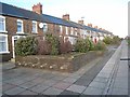
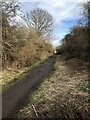
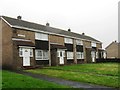
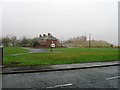
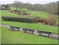

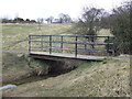
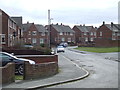
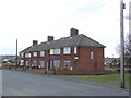
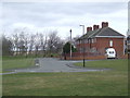
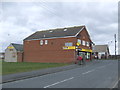
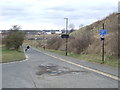
20 photos from this area
Area Information
Key information about the DH5 9AL including its size, population, and administrative classification.
- Area Type
- Postcode
- Area Size
- 1.3 hectares
- Population
- 1740
- Population Density
- 3005 people/km²
House Prices in DH5 9AL
88
Properties
£74,322
Average Sold Price
£30,000
Lowest Price
£105,000
Highest Price
Showing 88 properties
| Address | Type | Beds | Baths | Last Sale Price | Last Sale Date | |
|---|---|---|---|---|---|---|
| 9 George Street, Hetton Le Hole, Houghton Le Spring, DH5 9AL | house | 2 | 2 | £97,000 | Sep 2024 | |
| 36 George Street, Hetton Le Hole, Houghton Le Spring, DH5 9AL | house | 2 | 1 | £60,000 | May 2024 | |
| 30 George Street, Hetton Le Hole, Houghton Le Spring, DH5 9AL | Terraced | 2 | 1 | £102,000 | Feb 2022 | |
| 12 George Street, Hetton Le Hole, Houghton Le Spring, DH5 9AL | Semi-detached | 2 | 1 | £78,950 | Jul 2020 | |
| 2 George Street, Hetton Le Hole, Houghton Le Spring, DH5 9AL | house | - | - | £58,000 | Aug 2015 | |
| 25 George Street, Hetton Le Hole, Houghton Le Spring, DH5 9AL | house | 3 | - | £50,000 | Aug 2011 | |
| 35 George Street, Hetton Le Hole, Houghton Le Spring, DH5 9AL | Semi-detached | 2 | 1 | £95,000 | Nov 2008 | |
| 20 George Street, Hetton Le Hole, Houghton Le Spring, DH5 9AL | Semi-detached | 2 | 1 | £105,000 | Aug 2008 | |
| 21 George Street, Hetton Le Hole, Houghton Le Spring, DH5 9AL | Semi-detached | 2 | 1 | £72,500 | Jul 2008 | |
| 28 George Street, Hetton Le Hole, Houghton Le Spring, DH5 9AL | Terraced | - | - | £102,500 | May 2006 |
Page 1 of 9
Energy Efficiency in DH5 9AL
Amenities
Schools
| Rank | School | Type | Entry gender | Ages |
|---|
Explore more schools in this area
Go to Schools tabDemographics
Household Size
Two person
most common
Accommodation Type
Houses
most common
Tenure
66
majority
Ethnic Group
White
most common
Religion
N/A
most common
Household Composition
N/A
most common
Age
47
median
Adults (30-64 years)
most common
Household Deprivation
N/A
with no deprivation
NS-SEC
24
in Lower managerial occupations
Explore more demographic insights in this area
Go to Demographics tabPlanning
Planning Constraints
- Flood RiskPremium
- Ramsar Wetland SitesPremium
- Area of Outstanding Natural BeautyPremium
- Protected Nature ReservePremium
- Protected WoodlandPremium