Area Overview for DH4 6HH
Photos of DH4 6HH
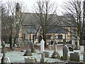
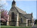
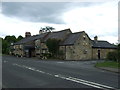
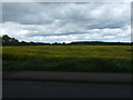
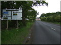
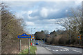
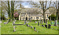
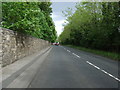
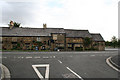
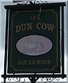
12 photos from this area
Area Information
Key information about the DH4 6HH including its size, population, and administrative classification.
- Area Type
- Postcode
- Area Size
- 6.7 hectares
- Population
- 1260
- Population Density
- 340 people/km²
House Prices in DH4 6HH
40
Properties
£261,030
Average Sold Price
£96,000
Lowest Price
£380,000
Highest Price
Showing 40 properties
| Address | Type | Beds | Baths | Last Sale Price | Last Sale Date | |
|---|---|---|---|---|---|---|
| 3 Castlefields, Bournmoor, DH4 6HH | Detached | 4 | 3 | £357,000 | Jan 2025 | |
| 20 Castlefields, Bournmoor, DH4 6HH | house | - | - | £380,000 | Jun 2023 | |
| 2 Castlefields, Bournmoor, DH4 6HH | house | - | - | £365,000 | Apr 2023 | |
| 19 Castlefields, Bournmoor, DH4 6HH | house | - | - | £345,000 | Oct 2022 | |
| 22 Castlefields, Bournmoor, DH4 6HH | Retail | 4 | 2 | £341,000 | Aug 2022 | |
| 40 Castlefields, Bournmoor, DH4 6HH | house | - | - | £322,500 | Mar 2022 | |
| 6 Castlefields, Bournmoor, DH4 6HH | house | - | - | £370,000 | Dec 2021 | |
| 11 Castlefields, Bournmoor, DH4 6HH | Detached | 4 | - | £325,000 | Oct 2021 | |
| 38 Castlefields, Bournmoor, DH4 6HH | house | - | - | £190,625 | Oct 2018 | |
| 35 Castlefields, Bournmoor, DH4 6HH | Detached | 4 | 1 | £272,500 | Sep 2015 |
Page 1 of 4
Energy Efficiency in DH4 6HH
Amenities
Schools
| Rank | School | Type | Entry gender | Ages |
|---|
Explore more schools in this area
Go to Schools tabDemographics
Household Size
Two person
most common
Accommodation Type
Houses
most common
Tenure
73
majority
Ethnic Group
White
most common
Religion
N/A
most common
Household Composition
N/A
most common
Age
47
median
Adults (30-64 years)
most common
Household Deprivation
N/A
with no deprivation
NS-SEC
30
in Lower managerial occupations
Explore more demographic insights in this area
Go to Demographics tabPlanning
Planning Constraints
- Flood RiskPremium
- Ramsar Wetland SitesPremium
- Area of Outstanding Natural BeautyPremium
- Protected Nature ReservePremium
- Protected WoodlandPremium