Area Overview for DH4 6EG
Photos of DH4 6EG
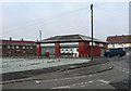
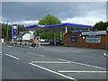
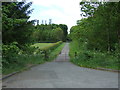
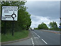
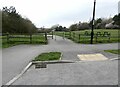
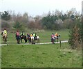
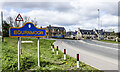
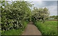
25 photos from this area
Area Information
Key information about the DH4 6EG including its size, population, and administrative classification.
- Area Type
- Postcode
- Area Size
- 1.2 hectares
- Population
- 1426
- Population Density
- 334 people/km²
House Prices in DH4 6EG
44
Properties
£54,273
Average Sold Price
£29,000
Lowest Price
£85,000
Highest Price
Showing 44 properties
| Address | Type | Beds | Baths | Last Sale Price | Last Sale Date | |
|---|---|---|---|---|---|---|
| 60 Marigold Crescent, Bournmoor, DH4 6EG | house | - | - | £40,000 | Apr 2024 | |
| 61 Marigold Crescent, Bournmoor, DH4 6EG | Terraced | 2 | 1 | £85,000 | Jun 2022 | |
| 48 Marigold Crescent, Bournmoor, DH4 6EG | Retail | 2 | 1 | £65,000 | Jun 2022 | |
| 69 Marigold Crescent, Bournmoor, DH4 6EG | Terraced | 1 | 1 | £80,000 | May 2021 | |
| 67 Marigold Crescent, Bournmoor, DH4 6EG | Semi-detached | - | - | £30,000 | Feb 2020 | |
| 52 Marigold Crescent, Bournmoor, DH4 6EG | Terraced | 2 | 1 | £58,000 | Jan 2019 | |
| 43 Marigold Crescent, Bournmoor, DH4 6EG | house | 2 | 1 | £59,000 | Sep 2017 | |
| 68 Marigold Crescent, Bournmoor, DH4 6EG | house | - | - | £42,000 | Jun 2015 | |
| 56 Marigold Crescent, Bournmoor, DH4 6EG | Terraced | - | - | £74,000 | Dec 2007 | |
| 59 Marigold Crescent, Bournmoor, DH4 6EG | Terraced | 2 | 1 | £29,000 | Jan 2003 |
Page 1 of 5
Energy Efficiency in DH4 6EG
Amenities
Schools
| Rank | School | Type | Entry gender | Ages |
|---|
Explore more schools in this area
Go to Schools tabDemographics
Household Size
Two person
most common
Accommodation Type
Houses
most common
Tenure
50
majority
Ethnic Group
White
most common
Religion
N/A
most common
Household Composition
N/A
most common
Age
47
median
Adults (30-64 years)
most common
Household Deprivation
N/A
with no deprivation
NS-SEC
25
in Lower managerial occupations
Explore more demographic insights in this area
Go to Demographics tabPlanning
Planning Constraints
- Flood RiskPremium
- Ramsar Wetland SitesPremium
- Area of Outstanding Natural BeautyPremium
- Protected Nature ReservePremium
- Protected WoodlandPremium