Area Overview for DH3 3PT
Photos of DH3 3PT
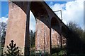
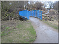
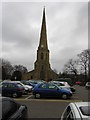
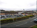
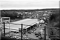
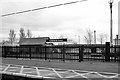
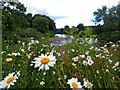
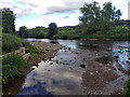
100 photos from this area
Area Information
Key information about the DH3 3PT including its size, population, and administrative classification.
- Area Type
- Postcode
- Area Size
- 1.7 hectares
- Population
- 1669
- Population Density
- 780 people/km²
House Prices in DH3 3PT
22
Properties
£206,131
Average Sold Price
£90,000
Lowest Price
£350,000
Highest Price
Showing 22 properties
| Address | Type | Beds | Baths | Last Sale Price | Last Sale Date | |
|---|---|---|---|---|---|---|
| 6 Lindisfarne Avenue, Chester Le Street, DH3 3PT | Bungalow | - | - | £295,000 | Jun 2024 | |
| 8 Lindisfarne Avenue, Chester Le Street, DH3 3PT | Bungalow | - | - | £209,100 | Jan 2013 | |
| Deneholme, 14 Lindisfarne Avenue, Chester Le Street, DH3 3PT | Bungalow | - | - | £245,000 | Aug 2007 | |
| 5 Lindisfarne Avenue, Chester Le Street, DH3 3PT | Semi-detached | - | - | £195,000 | Aug 2005 | |
| 18 Lindisfarne Avenue, Chester Le Street, DH3 3PT | Detached | - | - | £350,000 | Nov 2004 | |
| 7 Lindisfarne Avenue, Chester Le Street, DH3 3PT | Semi-detached | - | - | £90,000 | May 2002 | |
| Swandale, Lindisfarne Avenue, Chester Le Street, DH3 3PT | Detached | - | - | £139,950 | Mar 1999 | |
| 10 Lindisfarne Avenue, Chester Le Street, DH3 3PT | Detached | - | - | £125,000 | Jun 1996 | |
| 2 Lindisfarne Avenue, Chester Le Street, DH3 3PT | Detached | 3 | 1 | - | - | |
| Iona, 12 Lindisfarne Avenue, Chester Le Street, DH3 3PT | Bungalow | 3 | - | - | - |
Page 1 of 3
Energy Efficiency in DH3 3PT
Amenities
Schools
| Rank | School | Type | Entry gender | Ages |
|---|
Explore more schools in this area
Go to Schools tabDemographics
Household Size
Two person
most common
Accommodation Type
Houses
most common
Tenure
82
majority
Ethnic Group
White
most common
Religion
N/A
most common
Household Composition
N/A
most common
Age
47
median
Adults (30-64 years)
most common
Household Deprivation
N/A
with no deprivation
NS-SEC
44
in Lower managerial occupations
Explore more demographic insights in this area
Go to Demographics tabPlanning
Planning Constraints
- Flood RiskPremium
- Ramsar Wetland SitesPremium
- Area of Outstanding Natural BeautyPremium
- Protected Nature ReservePremium
- Protected WoodlandPremium