Area Overview for DH3 1JA
Photos of DH3 1JA
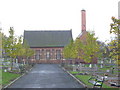

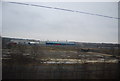
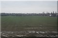
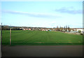
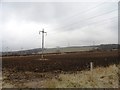
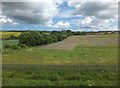
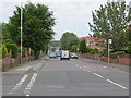
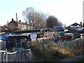
18 photos from this area
Area Information
Key information about the DH3 1JA including its size, population, and administrative classification.
- Area Type
- Postcode
- Area Size
- 8643 m²
- Population
- 1852
- Population Density
- 214266 people/km²
House Prices in DH3 1JA
22
Properties
£65,933
Average Sold Price
£35,000
Lowest Price
£87,800
Highest Price
Showing 22 properties
| Address | Type | Beds | Baths | Last Sale Price | Last Sale Date | |
|---|---|---|---|---|---|---|
| 72 Elisabeth Avenue, Elisabethville, Birtley, DH3 1JA | house | 4 | - | £35,000 | May 2011 | |
| 78 Elisabeth Avenue, Elisabethville, Birtley, DH3 1JA | Semi-detached | - | - | £75,000 | Apr 2009 | |
| 56 Elisabeth Avenue, Elisabethville, Birtley, DH3 1JA | house | 4 | - | £87,800 | Dec 2006 | |
| 62 Elisabeth Avenue, Elisabethville, Birtley, DH3 1JA | house | - | - | - | - | |
| 66 Elisabeth Avenue, Elisabethville, Birtley, DH3 1JA | Terraced | - | - | - | - | |
| 101 Elisabeth Avenue, Elisabethville, Birtley, DH3 1JA | house | - | - | - | - | |
| 99 Elisabeth Avenue, Elisabethville, Birtley, DH3 1JA | Terraced | - | - | - | - | |
| 103 Elisabeth Avenue, Elisabethville, Birtley, DH3 1JA | Terraced | - | - | - | - | |
| 105 Elisabeth Avenue, Elisabethville, Birtley, DH3 1JA | Bungalow | - | - | - | - | |
| 95 Elisabeth Avenue, Elisabethville, Birtley, DH3 1JA | Terraced | - | - | - | - |
Page 1 of 3
Energy Efficiency in DH3 1JA
Amenities
Schools
| Rank | School | Type | Entry gender | Ages |
|---|
Explore more schools in this area
Go to Schools tabDemographics
Household Size
Two person
most common
Accommodation Type
Houses
most common
Tenure
27
majority
Ethnic Group
White
most common
Religion
N/A
most common
Household Composition
N/A
most common
Age
47
median
Adults (30-64 years)
most common
Household Deprivation
N/A
with no deprivation
NS-SEC
14
in Lower managerial occupations
Explore more demographic insights in this area
Go to Demographics tabPlanning
Planning Constraints
- Flood RiskPremium
- Ramsar Wetland SitesPremium
- Area of Outstanding Natural BeautyPremium
- Protected Nature ReservePremium
- Protected WoodlandPremium