Area Overview for DH2 2XA
Photos of DH2 2XA
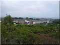
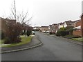
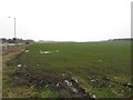
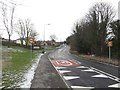
16 photos from this area
Area Information
Key information about the DH2 2XA including its size, population, and administrative classification.
- Area Type
- Postcode
- Area Size
- 3.7 hectares
- Population
- 1642
- Population Density
- 4276 people/km²
House Prices in DH2 2XA
34
Properties
£174,292
Average Sold Price
£79,950
Lowest Price
£505,000
Highest Price
Showing 34 properties
| Address | Type | Beds | Baths | Last Sale Price | Last Sale Date | |
|---|---|---|---|---|---|---|
| 26 Meadow Drive, Chester Le Street, DH2 2XA | Detached | 5 | 3 | £505,000 | Aug 2025 | |
| 18 Meadow Drive, Chester Le Street, DH2 2XA | house | - | - | £352,500 | Feb 2025 | |
| 33 Meadow Drive, Chester Le Street, DH2 2XA | Detached | 4 | 2 | £318,000 | Aug 2024 | |
| 5 Meadow Drive, Chester Le Street, DH2 2XA | Detached | 4 | 3 | £295,000 | Aug 2022 | |
| 15 Meadow Drive, Chester Le Street, DH2 2XA | Detached | 4 | 2 | £238,000 | Mar 2017 | |
| 20 Meadow Drive, Chester Le Street, DH2 2XA | Detached | 4 | 2 | £282,000 | Jul 2015 | |
| 14 Meadow Drive, Chester Le Street, DH2 2XA | house | - | - | £174,000 | Aug 2013 | |
| 37 Meadow Drive, Chester Le Street, DH2 2XA | house | 4 | - | £268,000 | May 2012 | |
| 19 Meadow Drive, Chester Le Street, DH2 2XA | Detached | 4 | - | £250,000 | Aug 2011 | |
| 43 Meadow Drive, Chester Le Street, DH2 2XA | house | - | - | £295,000 | Sep 2010 |
Page 1 of 4
Energy Efficiency in DH2 2XA
Amenities
Schools
| Rank | School | Type | Entry gender | Ages |
|---|
Explore more schools in this area
Go to Schools tabDemographics
Household Size
Two person
most common
Accommodation Type
Houses
most common
Tenure
85
majority
Ethnic Group
White
most common
Religion
N/A
most common
Household Composition
N/A
most common
Age
47
median
Adults (30-64 years)
most common
Household Deprivation
N/A
with no deprivation
NS-SEC
41
in Lower managerial occupations
Explore more demographic insights in this area
Go to Demographics tabPlanning
Planning Constraints
- Flood RiskPremium
- Ramsar Wetland SitesPremium
- Area of Outstanding Natural BeautyPremium
- Protected Nature ReservePremium
- Protected WoodlandPremium