Area Overview for DH2 2QR
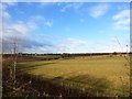
Photos of DH2 2QR


Area Information
Living in DH2 2QR means being part of a compact, residential cluster in England, where 1,928 people reside across a densely populated area of 767 people per square kilometre. This small postcode area is characterised by its proximity to essential services and transport links, making it a practical choice for those seeking a balance between convenience and community. The area’s demographic profile suggests a mature population, with a median age of 47 and a strong presence of adults aged 30–64. Daily life here is shaped by the availability of nearby retail outlets, including Co-op Pelton, Sainsburys Chester le, and Tesco Chester, which cater to local needs. Rail connectivity is robust, with five stations within practical reach, such as Station Road and Bullion Lane, offering easy access to broader regional networks. While the area is small, it is well-served by infrastructure that supports both domestic and commuter lifestyles. The mix of owner-occupied homes and the predominance of single-family residences reflect a community that prioritises stability and long-term living. For buyers, DH2 2QR presents a focused, self-contained environment with clear advantages in accessibility and local amenities.
- Area Type
- Postcode
- Area Size
- Not available
- Population
- 1928
- Population Density
- 767 people/km²
The property market in DH2 2QR is defined by a 58% home ownership rate, which suggests a mix of owner-occupied homes and rental properties. The area is predominantly composed of houses, which contrasts with regions where flats or apartments dominate. This housing stock indicates a community that values private, standalone residences, likely appealing to families or individuals seeking space and security. Given the small size of the postcode area, the housing options are limited to a focused cluster, meaning buyers should consider the immediate surroundings for broader choices. The prevalence of houses may also imply a lower density of properties compared to urban centres, which could influence property prices and availability. For buyers, this area offers a chance to invest in a stable, residential market with a clear emphasis on single-family homes. However, the limited scale of the area means that the local property landscape may not offer the diversity seen in larger towns or cities.
House Prices in DH2 2QR
No properties found in this postcode.
Energy Efficiency in DH2 2QR
Daily life in DH2 2QR is supported by a selection of nearby retail outlets, including Co-op Pelton, Sainsburys Chester le, and Tesco Chester. These shops provide essential goods and services, ensuring residents have access to groceries, household items, and other necessities without needing to travel far. The presence of five rail stations within practical reach, such as Station Road and Bullion Lane, enhances the area’s connectivity, allowing easy travel to surrounding regions. While the data does not specify parks or leisure facilities, the proximity to retail and transport suggests a lifestyle focused on convenience and practicality. The compact nature of the area means that amenities are concentrated, reducing the need for long commutes. For those prioritising accessibility, DH2 2QR offers a balance between local services and broader regional links, making it suitable for those who value both self-sufficiency and the ability to travel.
Amenities
Schools
| Rank | School | Type | Entry gender | Ages |
|---|
Explore more schools in this area
Go to Schools tabDemographics
DH2 2QR has a median age of 47, with the majority of residents falling within the 30–64 age range. This suggests a community of established professionals and families, rather than a younger or elderly demographic. Home ownership stands at 58%, indicating a moderate mix of owner-occupied properties and rental units. The area is predominantly composed of houses, which aligns with the typical housing stock in smaller residential clusters. The predominant ethnic group is White, reflecting the broader demographic trends in the region. The population density of 767 people per square kilometre implies a tightly knit community, though the exact implications for social interaction or public services are not quantified in the data. The absence of specific deprivation metrics means the area’s quality of life can be inferred from its infrastructure and amenities rather than socioeconomic indicators. This demographic profile paints a picture of a settled, middle-aged population with a focus on residential stability and proximity to essential services.
Household Size
Accommodation Type
Tenure
Ethnic Group
Religion
Household Composition
Age
Household Deprivation
NS-SEC
Explore more demographic insights in this area
Go to Demographics tabPlanning
Planning Constraints
- Flood RiskPremium
- Ramsar Wetland SitesPremium
- Area of Outstanding Natural BeautyPremium
- Protected Nature ReservePremium
- Protected WoodlandPremium