Area Overview for DH2 1RX
Photos of DH2 1RX
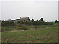
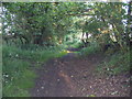
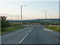
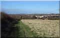

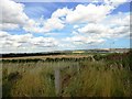
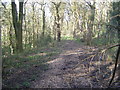
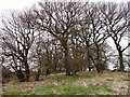
12 photos from this area
Area Information
Key information about the DH2 1RX including its size, population, and administrative classification.
- Area Type
- Postcode
- Area Size
- 5.8 hectares
- Population
- 1330
- Population Density
- 626 people/km²
House Prices in DH2 1RX
22
Properties
£127,044
Average Sold Price
£57,950
Lowest Price
£165,000
Highest Price
Showing 22 properties
| Address | Type | Beds | Baths | Last Sale Price | Last Sale Date | |
|---|---|---|---|---|---|---|
| 15 Abernethy, Ouston, DH2 1RX | Semi-detached | 3 | 1 | £165,000 | Jun 2018 | |
| 17 Abernethy, Ouston, DH2 1RX | house | 3 | 1 | £145,000 | Jan 2014 | |
| 22 Abernethy, Ouston, DH2 1RX | house | - | - | £133,000 | Jun 2011 | |
| 19 Abernethy, Ouston, DH2 1RX | house | 3 | - | £151,500 | Oct 2010 | |
| 13 Abernethy, Ouston, DH2 1RX | house | - | - | £150,000 | Jun 2009 | |
| 16 Abernethy, Ouston, DH2 1RX | house | - | - | £150,000 | Aug 2004 | |
| 3 Abernethy, Ouston, DH2 1RX | Semi-detached | - | - | £106,000 | Nov 2002 | |
| 20 Abernethy, Ouston, DH2 1RX | house | - | - | £84,950 | Jul 2002 | |
| 21 Abernethy, Ouston, DH2 1RX | Semi-detached | - | - | £57,950 | Oct 1999 | |
| 11 Abernethy, Ouston, DH2 1RX | Semi-detached | - | - | - | - |
Page 1 of 3
Energy Efficiency in DH2 1RX
Amenities
Schools
| Rank | School | Type | Entry gender | Ages |
|---|
Explore more schools in this area
Go to Schools tabDemographics
Household Size
Two person
most common
Accommodation Type
Houses
most common
Tenure
92
majority
Ethnic Group
White
most common
Religion
N/A
most common
Household Composition
N/A
most common
Age
47
median
Adults (30-64 years)
most common
Household Deprivation
N/A
with no deprivation
NS-SEC
35
in Lower managerial occupations
Explore more demographic insights in this area
Go to Demographics tabPlanning
Planning Constraints
- Flood RiskPremium
- Ramsar Wetland SitesPremium
- Area of Outstanding Natural BeautyPremium
- Protected Nature ReservePremium
- Protected WoodlandPremium