Area Overview for DH1 5XH
Photos of DH1 5XH
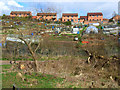
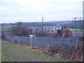
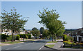

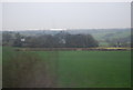
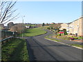
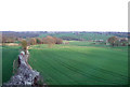
18 photos from this area
Area Information
Key information about the DH1 5XH including its size, population, and administrative classification.
- Area Type
- Postcode
- Area Size
- 8636 m²
- Population
- 1188
- Population Density
- 3704 people/km²
House Prices in DH1 5XH
28
Properties
£141,833
Average Sold Price
£44,000
Lowest Price
£275,000
Highest Price
Showing 28 properties
| Address | Type | Beds | Baths | Last Sale Price | Last Sale Date | |
|---|---|---|---|---|---|---|
| 44 Wolsingham Drive, Newton Hall, DH1 5XH | house | 4 | 2 | £275,000 | Jun 2023 | |
| 21 Wolsingham Drive, Newton Hall, DH1 5XH | Semi-detached | 3 | 1 | £185,000 | Jul 2022 | |
| 27 Wolsingham Drive, Newton Hall, DH1 5XH | house | - | - | £185,000 | Feb 2021 | |
| 52 Wolsingham Drive, Newton Hall, DH1 5XH | house | - | - | £151,000 | Apr 2019 | |
| 17 Wolsingham Drive, Newton Hall, DH1 5XH | Detached | 4 | 2 | £210,000 | Jul 2016 | |
| 58 Wolsingham Drive, Newton Hall, DH1 5XH | house | - | - | £155,500 | Nov 2010 | |
| 35 Wolsingham Drive, Newton Hall, DH1 5XH | Terraced | - | - | £180,000 | Jun 2006 | |
| 56 Wolsingham Drive, Newton Hall, DH1 5XH | Terraced | - | - | £152,000 | Feb 2006 | |
| 66 Wolsingham Drive, Newton Hall, DH1 5XH | Terraced | - | - | £147,500 | Sep 2005 | |
| 29 Wolsingham Drive, Newton Hall, DH1 5XH | Terraced | - | - | £173,000 | Aug 2004 |
Page 1 of 3
Energy Efficiency in DH1 5XH
Amenities
Schools
| Rank | School | Type | Entry gender | Ages |
|---|
Explore more schools in this area
Go to Schools tabDemographics
Household Size
Two person
most common
Accommodation Type
Houses
most common
Tenure
85
majority
Ethnic Group
White
most common
Religion
N/A
most common
Household Composition
N/A
most common
Age
47
median
Adults (30-64 years)
most common
Household Deprivation
N/A
with no deprivation
NS-SEC
46
in Lower managerial occupations
Explore more demographic insights in this area
Go to Demographics tabPlanning
Planning Constraints
- Flood RiskPremium
- Ramsar Wetland SitesPremium
- Area of Outstanding Natural BeautyPremium
- Protected Nature ReservePremium
- Protected WoodlandPremium