Area Overview for DH1 5NA
Photos of DH1 5NA
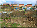
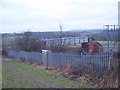
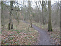
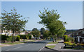

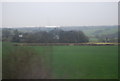
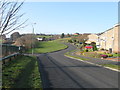
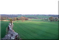
18 photos from this area
Area Information
Key information about the DH1 5NA including its size, population, and administrative classification.
- Area Type
- Postcode
- Area Size
- 1.7 hectares
- Population
- 1188
- Population Density
- 3704 people/km²
House Prices in DH1 5NA
50
Properties
£121,620
Average Sold Price
£49,000
Lowest Price
£265,000
Highest Price
Showing 50 properties
| Address | Type | Beds | Baths | Last Sale Price | Last Sale Date | |
|---|---|---|---|---|---|---|
| 11 Chillingham Road, Newton Hall, DH1 5NA | Semi-detached | 4 | 2 | £265,000 | Jun 2024 | |
| 46 Chillingham Road, Newton Hall, DH1 5NA | Flat | - | - | £88,000 | Mar 2024 | |
| 5 Chillingham Road, Newton Hall, DH1 5NA | house | - | - | £116,667 | Jan 2023 | |
| 14 Chillingham Road, Newton Hall, DH1 5NA | Semi-detached | 4 | 1 | £195,000 | Aug 2022 | |
| 3 Chillingham Road, Newton Hall, DH1 5NA | Retail | 4 | 2 | £239,950 | Feb 2022 | |
| 39 Chillingham Road, Newton Hall, DH1 5NA | Flat | - | - | £49,000 | Sep 2020 | |
| 47 Chillingham Road, Newton Hall, DH1 5NA | Flat | - | - | £78,000 | Jan 2020 | |
| 42 Chillingham Road, Newton Hall, DH1 5NA | Flat | 2 | 1 | £59,000 | Sep 2019 | |
| 30 Chillingham Road, Newton Hall, DH1 5NA | Semi-detached | 3 | 3 | £178,000 | Mar 2018 | |
| 44 Chillingham Road, Newton Hall, DH1 5NA | Flat | - | - | £82,500 | May 2017 |
Page 1 of 5
Energy Efficiency in DH1 5NA
Amenities
Schools
| Rank | School | Type | Entry gender | Ages |
|---|
Explore more schools in this area
Go to Schools tabDemographics
Household Size
Two person
most common
Accommodation Type
Houses
most common
Tenure
85
majority
Ethnic Group
White
most common
Religion
N/A
most common
Household Composition
N/A
most common
Age
47
median
Adults (30-64 years)
most common
Household Deprivation
N/A
with no deprivation
NS-SEC
46
in Lower managerial occupations
Explore more demographic insights in this area
Go to Demographics tabPlanning
Planning Constraints
- Flood RiskPremium
- Ramsar Wetland SitesPremium
- Area of Outstanding Natural BeautyPremium
- Protected Nature ReservePremium
- Protected WoodlandPremium