Area Overview for DH1 4QF
Photos of DH1 4QF
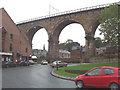
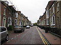
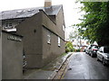
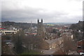
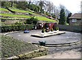
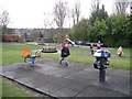


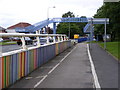
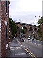
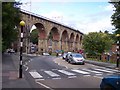
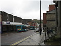
100 photos from this area
Area Information
Key information about the DH1 4QF including its size, population, and administrative classification.
- Area Type
- Postcode
- Area Size
- 3191 m²
- Population
- 1849
- Population Density
- 579390 people/km²
House Prices in DH1 4QF
11
Properties
£258,667
Average Sold Price
£102,000
Lowest Price
£350,000
Highest Price
Showing 11 properties
| Address | Type | Beds | Baths | Last Sale Price | Last Sale Date | |
|---|---|---|---|---|---|---|
| 2 Beech Crest, Durham, DH1 4QF | house | - | - | £330,000 | Mar 2025 | |
| 7 Beech Crest, Durham, DH1 4QF | Terraced | 3 | - | £310,000 | Feb 2021 | |
| 6 Beech Crest, Durham, DH1 4QF | Terraced | 5 | 2 | £350,000 | Nov 2018 | |
| 5 Beech Crest, Durham, DH1 4QF | Terraced | 5 | 1 | £330,000 | Jul 2018 | |
| Bede Rest, Beech Crest, Durham, DH1 4QF | Detached | - | - | £130,000 | Oct 2000 | |
| 4 Beech Crest, Durham, DH1 4QF | Terraced | - | - | £102,000 | Jul 1998 | |
| 1C Beech Crest, Durham, DH1 4QF | Flat | - | - | - | - | |
| 1A Beech Crest, Durham, DH1 4QF | Flat | - | - | - | - | |
| 1B Beech Crest, Durham, DH1 4QF | Flat | - | - | - | - | |
| 1 Beech Crest, Durham, DH1 4QF | house | - | - | - | - |
Page 1 of 2
Energy Efficiency in DH1 4QF
Amenities
Schools
| Rank | School | Type | Entry gender | Ages |
|---|
Explore more schools in this area
Go to Schools tabDemographics
Household Size
Family (3-5 people)
most common
Accommodation Type
Houses
most common
Tenure
59
majority
Ethnic Group
White
most common
Religion
N/A
most common
Household Composition
N/A
most common
Age
22
median
Young Adults (15-29 years)
most common
Household Deprivation
N/A
with no deprivation
NS-SEC
29
in Lower managerial occupations
Explore more demographic insights in this area
Go to Demographics tabPlanning
Planning Constraints
- Flood RiskPremium
- Ramsar Wetland SitesPremium
- Area of Outstanding Natural BeautyPremium
- Protected Nature ReservePremium
- Protected WoodlandPremium