Area Overview for DH1 3RR
Photos of DH1 3RR

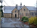

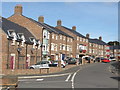
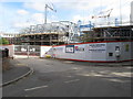
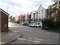
55 photos from this area
Area Information
Key information about the DH1 3RR including its size, population, and administrative classification.
- Area Type
- Postcode
- Area Size
- 22.8 hectares
- Population
- 1612
- Population Density
- 1395 people/km²
House Prices in DH1 3RR
36
Properties
£781,393
Average Sold Price
£288,000
Lowest Price
£1,560,000
Highest Price
Showing 36 properties
| Address | Type | Beds | Baths | Last Sale Price | Last Sale Date | |
|---|---|---|---|---|---|---|
| Melrose, Bells Folly, Potters Bank, Durham, DH1 3RR | house | - | - | £845,000 | May 2022 | |
| Longridge, Potters Bank, Durham, DH1 3RR | Detached | 4 | - | £960,000 | Feb 2022 | |
| Ansford, Potters Bank, Durham, DH1 3RR | Land | - | - | £850,500 | Sep 2021 | |
| Hillcrest, Potters Bank, Durham, DH1 3RR | house | - | - | £1,525,000 | Jan 2020 | |
| Observatory House, Potters Bank, Durham, DH1 3RR | Semi-detached | - | - | £1,560,000 | Apr 2019 | |
| South Lodge, Bells Folly, Potters Bank, Durham, DH1 3RR | Detached | 5 | 4 | £700,000 | Aug 2017 | |
| Longstone, Bells Folly, Potters Bank, Durham, DH1 3RR | Terraced | - | - | £390,000 | Sep 2016 | |
| Cranleigh, Bells Folly, Potters Bank, Durham, DH1 3RR | house | 4 | - | £550,000 | Aug 2016 | |
| Pastoral, Potters Bank, Durham, DH1 3RR | house | 5 | - | £970,000 | Apr 2015 | |
| Woodhey, Bells Folly, Potters Bank, Durham, DH1 3RR | Detached | 5 | - | £675,000 | Aug 2014 |
Page 1 of 4
Energy Efficiency in DH1 3RR
Amenities
Schools
| Rank | School | Type | Entry gender | Ages |
|---|
Explore more schools in this area
Go to Schools tabDemographics
Household Size
Family (3-5 people)
most common
Accommodation Type
Houses
most common
Tenure
75
majority
Ethnic Group
White
most common
Religion
N/A
most common
Household Composition
N/A
most common
Age
47
median
Adults (30-64 years)
most common
Household Deprivation
N/A
with no deprivation
NS-SEC
40
in Lower managerial occupations
Explore more demographic insights in this area
Go to Demographics tabPlanning
Planning Constraints
- Flood RiskPremium
- Ramsar Wetland SitesPremium
- Area of Outstanding Natural BeautyPremium
- Protected Nature ReservePremium
- Protected WoodlandPremium