Area Overview for DH1 2YD
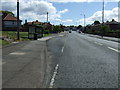
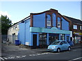
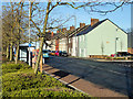
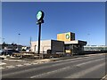
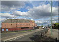
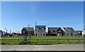
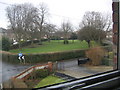
Photos of DH1 2YD


Area Information
Living in DH1 2YD means being part of a small, tightly knit residential cluster in England. With a population of 1,346, this area is characterised by its compact size and focus on family-oriented living. The community is predominantly composed of adults aged 30–64, reflecting a mature demographic that likely prioritises stability and established amenities. The area’s housing stock is largely made up of houses, offering a sense of space and privacy. Nearby, a range of primary schools and retail outlets provide practical convenience for daily life. While the postcode is small, it is strategically positioned near rail connections, including Durham Railway Station, which links residents to broader regional networks. The area’s low flood risk and absence of protected natural sites suggest a relatively straightforward planning environment. However, the high crime risk score indicates a need for vigilance. For those seeking a quiet, family-focused environment with access to essential services, DH1 2YD offers a blend of practicality and proximity to key infrastructure.
- Area Type
- Postcode
- Area Size
- Not available
- Population
- 1346
- Population Density
- Not available
DH1 2YD is a small area with a housing stock that is 50% owner-occupied, indicating a mix of private and rental properties. The accommodation type is primarily houses, which suggests a focus on family homes rather than apartments or terraced housing. This makes the area attractive to buyers seeking space and privacy, though the limited size of the postcode may mean property choices are constrained to a small number of homes. The owner-occupation rate implies a stable market with long-term residents, which could reduce turnover and competition. For buyers, this dynamic may mean fewer properties are available for purchase, but those that are listed are likely to be well-maintained and suited to family living. The proximity to rail and retail amenities further enhances the appeal of homes in this area, particularly for those prioritising convenience.
House Prices in DH1 2YD
No properties found in this postcode.
Energy Efficiency in DH1 2YD
The lifestyle in DH1 2YD is shaped by its proximity to retail and rail amenities. Local shops such as Lidl Dragonville, Iceland Bishop, and Iceland Dragonville provide everyday essentials, reducing the need for long trips to larger centres. The area’s rail connections, including Durham Railway Station and Bullion Lane, Chester, offer access to broader networks, facilitating travel for work, shopping, or leisure. While the data does not mention parks or leisure facilities, the presence of multiple schools and retail outlets suggests a community-oriented environment. The compact nature of the postcode means that amenities are within practical reach, contributing to a convenient, self-contained lifestyle. For residents, this balance of local services and transport links supports a practical, family-friendly daily routine.
Amenities
Schools
Residents of DH1 2YD have access to a cluster of primary schools, including Durham Gilesgate Primary School, St Hild’s College Church of England Aided Primary School, and Gilesgate Junior School. These institutions are all rated either ‘good’ or unspecified by Ofsted, providing a range of educational options for families. The presence of multiple primary schools within the area suggests a strong focus on local education, reducing the need for long commutes. For parents, this variety may offer flexibility in choosing a school that aligns with their child’s needs. The repetition of St Hild’s College in the data highlights its prominence, though the exact number of distinct schools is unclear. Overall, the availability of primary education within walking distance supports the area’s appeal to families seeking a settled, school-friendly environment.
| Rank | School | Type | Entry gender | Ages |
|---|
Explore more schools in this area
Go to Schools tabDemographics
The population of DH1 2YD has a median age of 47, with the majority of residents falling within the 30–64 age range. This suggests a community that is largely composed of working-age adults and older families, rather than younger professionals or retirees. Home ownership stands at 50%, indicating a balanced mix of owner-occupied and rental properties. The accommodation type is predominantly houses, which aligns with the area’s residential character and likely appeal to families seeking space. The predominant ethnic group is White, reflecting a homogenous demographic profile. While specific data on deprivation is not provided, the age and ownership statistics suggest a stable, middle-income community. The absence of detailed diversity metrics means the area’s social composition remains largely defined by its demographic norms. For homebuyers, this profile may indicate a conservative, low-turnover market with established neighbourhood dynamics.
Household Size
Accommodation Type
Tenure
Ethnic Group
Religion
Household Composition
Age
Household Deprivation
NS-SEC
Explore more demographic insights in this area
Go to Demographics tabPlanning
Planning Constraints
- Flood RiskPremium
- Ramsar Wetland SitesPremium
- Area of Outstanding Natural BeautyPremium
- Protected Nature ReservePremium
- Protected WoodlandPremium