Area Overview for DH1 2EB
Photos of DH1 2EB

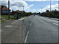
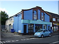

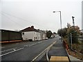
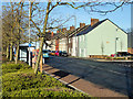

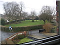
40 photos from this area
Area Information
Key information about the DH1 2EB including its size, population, and administrative classification.
- Area Type
- Postcode
- Area Size
- 1.5 hectares
- Population
- 1732
- Population Density
- 1003 people/km²
House Prices in DH1 2EB
41
Properties
£84,030
Average Sold Price
£19,150
Lowest Price
£132,500
Highest Price
Showing 41 properties
| Address | Type | Beds | Baths | Last Sale Price | Last Sale Date | |
|---|---|---|---|---|---|---|
| 6 Goodyear Crescent, Sherburn Road Estate, Durham, DH1 2EB | house | 3 | - | £132,500 | Jun 2025 | |
| 32 Goodyear Crescent, Sherburn Road Estate, Durham, DH1 2EB | house | 3 | 1 | £99,000 | Mar 2024 | |
| 15 Goodyear Crescent, Sherburn Road Estate, Durham, DH1 2EB | Terraced | 3 | 1 | £86,500 | Apr 2019 | |
| 1 Goodyear Crescent, Sherburn Road Estate, Durham, DH1 2EB | Semi-detached | 3 | - | £83,000 | May 2017 | |
| 34 Goodyear Crescent, Sherburn Road Estate, Durham, DH1 2EB | Semi-detached | 3 | - | £19,150 | Dec 2001 | |
| 38 Goodyear Crescent, Sherburn Road Estate, Durham, DH1 2EB | Semi-detached | 3 | 1 | - | - | |
| 31 Goodyear Crescent, Sherburn Road Estate, Durham, DH1 2EB | Terraced | 3 | 1 | - | - | |
| 1 Londonderry Avenue, Sherburn Road Estate, Durham, DH1 2EB | undefined | - | - | - | - | |
| 5 Goodyear Crescent, Sherburn Road Estate, Durham, DH1 2EB | house | - | - | - | - | |
| 19 Goodyear Crescent, Sherburn Road Estate, Durham, DH1 2EB | house | - | - | - | - |
Page 1 of 5
Energy Efficiency in DH1 2EB
Amenities
Schools
| Rank | School | Type | Entry gender | Ages |
|---|
Explore more schools in this area
Go to Schools tabDemographics
Household Size
Family (3-5 people)
most common
Accommodation Type
Houses
most common
Tenure
20
majority
Ethnic Group
White
most common
Religion
N/A
most common
Household Composition
N/A
most common
Age
47
median
Adults (30-64 years)
most common
Household Deprivation
N/A
with no deprivation
NS-SEC
15
in Lower managerial occupations
Explore more demographic insights in this area
Go to Demographics tabPlanning
Planning Constraints
- Flood RiskPremium
- Ramsar Wetland SitesPremium
- Area of Outstanding Natural BeautyPremium
- Protected Nature ReservePremium
- Protected WoodlandPremium