Area Overview for DH1 2AH
Photos of DH1 2AH
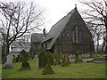
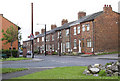
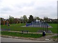
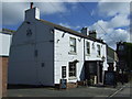

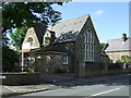
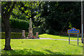
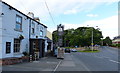
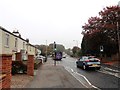
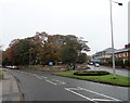
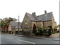
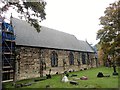
56 photos from this area
Area Information
Key information about the DH1 2AH including its size, population, and administrative classification.
- Area Type
- Postcode
- Area Size
- 8242 m²
- Population
- 1803
- Population Density
- 3058 people/km²
House Prices in DH1 2AH
28
Properties
£140,616
Average Sold Price
£52,500
Lowest Price
£256,350
Highest Price
Showing 28 properties
| Address | Type | Beds | Baths | Last Sale Price | Last Sale Date | |
|---|---|---|---|---|---|---|
| 68 Thorndale Road, Belmont, DH1 2AH | house | - | - | £190,000 | May 2023 | |
| 84 Thorndale Road, Belmont, DH1 2AH | Semi-detached | 3 | 1 | £152,500 | Jan 2023 | |
| 80 Thorndale Road, Belmont, DH1 2AH | house | - | - | £256,350 | Dec 2021 | |
| 82 Thorndale Road, Belmont, DH1 2AH | house | - | - | £160,000 | Nov 2021 | |
| 58 Thorndale Road, Belmont, DH1 2AH | house | - | - | £155,000 | Jun 2021 | |
| 74 Thorndale Road, Belmont, DH1 2AH | Semi-detached | 3 | - | £170,000 | Jan 2017 | |
| 62 Thorndale Road, Belmont, DH1 2AH | house | - | - | £162,000 | May 2016 | |
| 34 Thorndale Road, Belmont, DH1 2AH | Semi-detached | 3 | 1 | £145,000 | Nov 2014 | |
| 54 Thorndale Road, Belmont, DH1 2AH | house | - | - | £149,000 | Jul 2011 | |
| 50 Thorndale Road, Belmont, DH1 2AH | Semi-detached | 3 | 1 | £119,500 | Jan 2011 |
Page 1 of 3
Energy Efficiency in DH1 2AH
Amenities
Schools
| Rank | School | Type | Entry gender | Ages |
|---|
Explore more schools in this area
Go to Schools tabDemographics
Household Size
Two person
most common
Accommodation Type
Houses
most common
Tenure
91
majority
Ethnic Group
White
most common
Religion
N/A
most common
Household Composition
N/A
most common
Age
47
median
Adults (30-64 years)
most common
Household Deprivation
N/A
with no deprivation
NS-SEC
45
in Lower managerial occupations
Explore more demographic insights in this area
Go to Demographics tabPlanning
Planning Constraints
- Flood RiskPremium
- Ramsar Wetland SitesPremium
- Area of Outstanding Natural BeautyPremium
- Protected Nature ReservePremium
- Protected WoodlandPremium