Area Overview for DH1 1WB
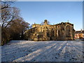
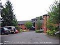
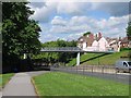
Photos of DH1 1WB
Area Information
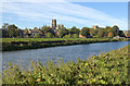
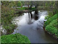
Living in DH1 1WB means residing in a very tight residential cluster within Durham, England. This specific postcode covers just 2717 square metres and counts 1706 residents who call this small space home. You are looking at an area with extreme density, where 1706 people occupy fewer than three hectares of land. Despite the high concentration of neighbours, the layout consists primarily of houses rather than apartment blocks. Daily life here involves interacting closely with your immediate surroundings, as the physical space is limited. The absence of large open areas is defined by the sheer volume of people sharing a small footprint. You will find yourself in one of the more densely populated pockets in the region. It is a place where proximity dictates your daily routine. Every street is part of a larger web of 1706 individuals living close together. The area functions as a focused container for community life. There is no buffer zone between residents; boundaries are immediate. This compact nature creates a distinct living rhythm for anyone purchasing homes in DH1 1WB.
- Area Type
- Postcode
- Area Size
- 2717 m²
- Population
- 1706
- Population Density
- 627873 people/km²
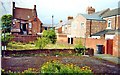
The property market in DH1 1WB is defined by a high volume of rental homes relative to owner-occupied ones. Only 33 per cent of residents own their property, meaning you will predominantly encounter houses available to rent. The accommodation type is specified as houses, aligning with the traditional housing stock found in this part of Durham. This ownership split suggests that buyers looking at homes in DH1 1WB will find a competitive entry point through purchases, but the rental inventory is larger. If you are buying, the low ownership percentage indicates stable turnover in the housing stock. Values here reflect the high population density of 1706 people within just 2717 square metres. This scarcity of land often drives prices for available inventory. You must consider that most people here are renting rather than building equity in their current property. The market is not characterised by owner-occupied stability in the immediate vicinity of these houses. Instead, it operates as a dynamic rental zone with a minority of static owners. This structure affects how you view property values and tenancy agreements in the area.
House Prices in DH1 1WB
Showing 5 properties
| Address | Type | Beds | Baths | Last Sale Price | Last Sale Date | |
|---|---|---|---|---|---|---|
| 1 Chapel Mews, Gilesgate, DH1 1WB | Detached | - | - | £355,000 | Jan 2006 | |
| 3 Chapel Mews, Gilesgate, DH1 1WB | Semi-detached | - | - | £350,000 | Jun 2005 | |
| 2 Chapel Mews, Gilesgate, DH1 1WB | Semi-detached | - | - | £260,000 | Mar 2002 | |
| 99A Gilesgate, Durham, DH1 1WB | undefined | - | - | - | - | |
| 6 Chapel Mews, Gilesgate, DH1 1WB | Bungalow | 1 | 1 | - | - |
Energy Efficiency in DH1 1WB
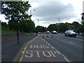
Your lifestyle in DH1 1WB benefits from nearby amenities that are within practical reach of the postcode. Tesco Durham, Sainsburys Gilesgate, and another Tesco location provide essential shopping options for groceries and household goods. You are close to these major retailers without needing to travel far outside the immediate Durham area. For travel, four rail stations serve the region including Durham Railway Station and Bullion Lane. Travel to Chester is also listed as a notable connection, offering regional movement. There are no parks, cinemas, or leisure centres listed in the provided data for immediate proximity. Your daily life revolves around accessing supermarkets and using the rail network for commuting. The retail sector offers variety with five notable shops or retailers within range. Convenience is built into the layout of stores like Sainsburys Gilesgate and the Tesco branches. You will find your weekly shop easily accessible from your home. The rail connections ensure you can reach Durham city and larger towns efficiently. While cultural venues are not listed here, the transport links mitigate the lack of local leisure facilities. Your commute relies on these trains to connect you to the wider city services.
Amenities
Schools
Families living in DH1 1WB have access to two primary schools nearby that serve the local community. St Joseph's Roman Catholic Voluntary Aided Primary School, Durham, is the first option for students entering the system. This institution provides a Catholic educational foundation for younger children. The second school is St Joseph's Catholic Primary School, Gilesgate, which also offers primary education. Both schools share the Catholic ethos and cater to the neighbourhood requirements. There is no data provided regarding Ofsted ratings for either institution, so you cannot verify their current inspection status from the available figures. The concentration of Catholic primary schools in this short list suggests a strong faith-based provision within the Durham education network. There are no secondary schools listed in the immediate vicinity, meaning older children likely travel further for education. The proximity of these two primary institutions makes them the central educational hubs for residents of DH1 1WB. When viewing homes in DH1 1WB, the availability of these two specific primary schools is a key factor for family planning.
| Rank | School | Type | Entry gender | Ages |
|---|
Explore more schools in this area
Go to Schools tabDemographics
The community in DH1 1WB is dominated by young adults between the ages of 15 and 29. The median age for residents stands at 22 years old, creating a youthful demographic profile. Most households include individuals in this young adult bracket, suggesting a population of students or those early in their career. Home ownership levels sit at 33 per cent, meaning two-thirds of residents rent their accommodation. The majority of dwellings are houses, which is somewhat typical for the Durham region. The predominant ethnic group is White, forming the core of the local population. You will not find significant statistical data regarding deprivation levels in the provided information for this specific postcode. This lack of data prevents a detailed analysis of income inequality within these 1706 residents. The area functions as a young, largely renting community housed in traditional properties. The low ownership rate indicates a transit population that moves frequently. Young families and students likely cycle through these houses regularly. The age profile confirms this is not a retirement or family suburb. It is a hub for young people navigating their adult lives in Durham.
Household Size
Accommodation Type
Tenure
Ethnic Group
Religion
Household Composition
Age
Household Deprivation
NS-SEC
Explore more demographic insights in this area
Go to Demographics tabPlanning
Planning Constraints
- Flood RiskPremium
- Ramsar Wetland SitesPremium
- Area of Outstanding Natural BeautyPremium
- Protected Nature ReservePremium
- Protected WoodlandPremium