Area Overview for DH1 1QU
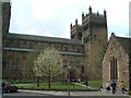
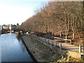
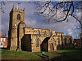
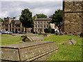
Photos of DH1 1QU


Area Information
DH1 1QU is a small residential postcode area in England, home to 6,464 people spread across a densely populated landscape of 1,138 people per square kilometre. This compact cluster of homes sits at the heart of a community defined by its youthful demographic, with a median age of just 22 years. The area’s proximity to Durham, a historic city with rich cultural and educational offerings, makes it a practical choice for young professionals and students. Daily life here is shaped by a mix of local amenities, including retail outlets like Tesco Durham and nearby rail connections, which provide easy access to the wider region. While the area lacks large-scale infrastructure, its small size fosters a tight-knit environment where residents often know their neighbours. The housing stock is dominated by individual homes, though the high population density suggests a mix of terraced and semi-detached properties. For those seeking a compact, accessible location with a young, dynamic population, DH1 1QU offers a distinct blend of practicality and community character.
- Area Type
- Postcode
- Area Size
- Not available
- Population
- 6464
- Population Density
- 1138 people/km²
The property market in DH1 1QU is characterised by a low home ownership rate of 25%, indicating that the majority of residents rent rather than own their homes. This suggests a rental market that may cater to students, temporary workers, or those seeking short-term accommodation. The accommodation type is primarily houses, which, in a densely populated area like this, likely means a mix of terraced or semi-detached properties. Given the small size of the postcode, the housing stock is limited, and buyers may find competition for available properties. The low ownership rate also implies that landlords and letting agencies play a significant role in the local market. For those considering purchasing, the area’s compact nature means that properties are likely to be close to key amenities such as schools and transport links. However, the high proportion of renters may affect long-term investment potential, as demand is driven by transient populations rather than stable owner-occupation.
House Prices in DH1 1QU
No properties found in this postcode.
Energy Efficiency in DH1 1QU
The lifestyle in DH1 1QU is shaped by its proximity to retail and transport hubs. Residents have easy access to Tesco Durham, Iceland Durham, and other local stores, ensuring convenience for everyday shopping. The rail network, with stations like Durham Railway Station and Bullion Lane, provides efficient connections to the city and surrounding areas, supporting both commuter and leisure travel. While the area lacks large parks or recreational spaces, its compact size means that essential amenities are within walking or short driving distance. The presence of multiple schools and a youthful demographic suggests a community that is active and socially engaged. However, the absence of detailed information on dining or leisure venues means that the full range of lifestyle options remains somewhat unclear. For those prioritising practicality and accessibility, DH1 1QU offers a straightforward, no-frills environment with a focus on connectivity and convenience.
Amenities
Schools
Residents of DH1 1QU have access to a range of educational institutions, including St Oswald’s Church of England Aided Primary and Nursery School, which holds a ‘good’ Ofsted rating. This state-funded primary school provides a solid foundation for younger children, while the nearby Durham Sixth Form Centre caters to older students, though it is listed as a primary school in the data—a potential inconsistency. For independent education, the area is served by Durham High School for Girls, The Chorister School, and Bow School, all of which offer private alternatives. This mix of state and independent schools gives families flexibility, though the availability of high-quality state education is notable. The presence of multiple schools within reach suggests that the area is well-suited for families prioritising educational options. However, the exact catchment areas and school performance data beyond Ofsted ratings are not specified, which may be a consideration for prospective buyers.
| Rank | School | Type | Entry gender | Ages |
|---|
Explore more schools in this area
Go to Schools tabDemographics
The population of DH1 1QU is overwhelmingly young, with 15-29-year-olds making up the largest age group. This skew is reflected in the median age of 22, suggesting a community dominated by students, recent graduates, and young professionals. Home ownership is relatively low at 25%, indicating that a significant proportion of residents rent their homes, likely due to the area’s role as a student or transient population hub. The predominant accommodation type is houses, which, combined with the high population density, implies a mix of smaller, multi-occupancy properties. The ethnic composition is predominantly White, with no data provided on other groups. The low home ownership rate and youthful profile suggest a community in flux, where temporary tenancies and student housing may be common. This dynamic environment could influence local services and amenities, which must cater to a transient population with evolving needs.
Household Size
Accommodation Type
Tenure
Ethnic Group
Religion
Household Composition
Age
Household Deprivation
NS-SEC
Explore more demographic insights in this area
Go to Demographics tabPlanning
Planning Constraints
- Flood RiskPremium
- Ramsar Wetland SitesPremium
- Area of Outstanding Natural BeautyPremium
- Protected Nature ReservePremium
- Protected WoodlandPremium