Area Overview for DH1 1NE
Photos of DH1 1NE
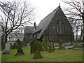
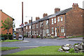
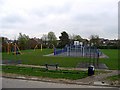
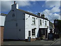
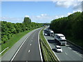
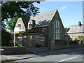
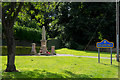
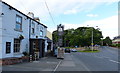
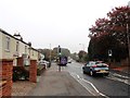
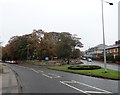
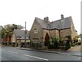
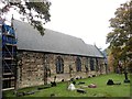
56 photos from this area
Area Information
Key information about the DH1 1NE including its size, population, and administrative classification.
- Area Type
- Postcode
- Area Size
- 1.5 hectares
- Population
- 1318
- Population Density
- 90307 people/km²
House Prices in DH1 1NE
44
Properties
£92,350
Average Sold Price
£20,350
Lowest Price
£130,000
Highest Price
Showing 44 properties
| Address | Type | Beds | Baths | Last Sale Price | Last Sale Date | |
|---|---|---|---|---|---|---|
| 98 Broome Road, Carrville, DH1 1NE | Detached | 2 | 1 | £90,000 | Jan 2025 | |
| 118 Broome Road, Carrville, DH1 1NE | house | - | - | £90,000 | Jan 2025 | |
| 106 Broome Road, Carrville, DH1 1NE | Semi-detached | 2 | - | £93,000 | Apr 2024 | |
| 81 Broome Road, Carrville, DH1 1NE | Semi-detached | 2 | - | £130,000 | Aug 2022 | |
| 96 Broome Road, Carrville, DH1 1NE | house | - | - | £95,000 | Oct 2021 | |
| 71 Broome Road, Carrville, DH1 1NE | Semi-detached | 2 | 1 | £107,500 | Jun 2019 | |
| 86 Broome Road, Carrville, DH1 1NE | Semi-detached | 3 | 2 | £95,000 | May 2019 | |
| 104 Broome Road, Carrville, DH1 1NE | Semi-detached | 2 | 1 | £104,000 | Dec 2017 | |
| 132 Broome Road, Carrville, DH1 1NE | house | - | - | £120,000 | Nov 2017 | |
| 114 Broome Road, Carrville, DH1 1NE | house | 2 | - | £97,500 | Apr 2017 |
Page 1 of 5
Energy Efficiency in DH1 1NE
Amenities
Schools
| Rank | School | Type | Entry gender | Ages |
|---|
Explore more schools in this area
Go to Schools tabDemographics
Household Size
One person
most common
Accommodation Type
Houses
most common
Tenure
63
majority
Ethnic Group
White
most common
Religion
N/A
most common
Household Composition
N/A
most common
Age
47
median
Adults (30-64 years)
most common
Household Deprivation
N/A
with no deprivation
NS-SEC
25
in Lower managerial occupations
Explore more demographic insights in this area
Go to Demographics tabPlanning
Planning Constraints
- Flood RiskPremium
- Ramsar Wetland SitesPremium
- Area of Outstanding Natural BeautyPremium
- Protected Nature ReservePremium
- Protected WoodlandPremium