Area Overview for DH1 1HY
Photos of DH1 1HY
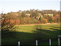
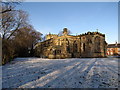
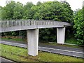
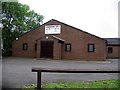
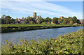
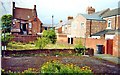
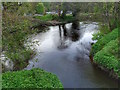
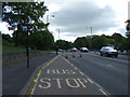
100 photos from this area
Area Information
Key information about the DH1 1HY including its size, population, and administrative classification.
- Area Type
- Postcode
- Area Size
- 1.1 hectares
- Population
- Not available
- Population Density
- Not available
House Prices in DH1 1HY
45
Properties
£228,039
Average Sold Price
£38,000
Lowest Price
£630,000
Highest Price
Showing 45 properties
| Address | Type | Beds | Baths | Last Sale Price | Last Sale Date | |
|---|---|---|---|---|---|---|
| 83A Gilesgate, Durham, DH1 1HY | Maisonette | - | - | £189,950 | Nov 2023 | |
| 62 Gilesgate, Durham, DH1 1HY | house | 3 | 1 | £245,000 | Aug 2021 | |
| 70 Gilesgate, Durham, DH1 1HY | Terraced | 5 | 2 | £330,000 | Oct 2020 | |
| Brew House, 80 Gilesgate, Durham, DH1 1HY | Flat | 10 | 2 | £630,000 | Sep 2020 | |
| 70A Gilesgate, Durham, DH1 1HY | house | - | - | £310,000 | Mar 2020 | |
| 64 Gilesgate, Durham, DH1 1HY | Terraced | 3 | 1 | £305,500 | Dec 2019 | |
| 90 Gilesgate, Durham, DH1 1HY | Semi-detached | 4 | 2 | £395,000 | Mar 2019 | |
| 77 Gilesgate, Durham, DH1 1HY | Terraced | 6 | 2 | £320,000 | Apr 2015 | |
| 78 Gilesgate, Durham, DH1 1HY | Terraced | 5 | 2 | £250,000 | Mar 2014 | |
| 76 Gilesgate, Durham, DH1 1HY | house | - | - | £216,016 | Oct 2013 |
Page 1 of 5
Energy Efficiency in DH1 1HY
Amenities
Schools
| Rank | School | Type | Entry gender | Ages |
|---|
Explore more schools in this area
Go to Schools tabDemographics
Household Size
One person
most common
Accommodation Type
Houses
most common
Tenure
33
majority
Ethnic Group
White
most common
Religion
N/A
most common
Household Composition
N/A
most common
Age
22
median
Young Adults (15-29 years)
most common
Household Deprivation
N/A
with no deprivation
NS-SEC
19
in Lower managerial occupations
Explore more demographic insights in this area
Go to Demographics tabPlanning
Planning Constraints
- Flood RiskPremium
- Ramsar Wetland SitesPremium
- Area of Outstanding Natural BeautyPremium
- Protected Nature ReservePremium
- Protected WoodlandPremium