Area Overview for Craster
Photos of Craster
Area Information
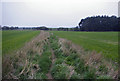
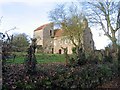
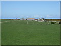
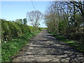
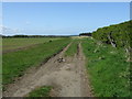
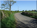
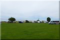
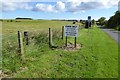
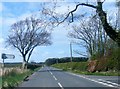
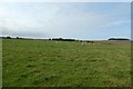
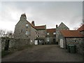
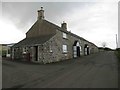
Craster is a small civil parish located on the Northumberland coast, covering an area of 9.4 km². This fishing village sits approximately eight miles northeast of Alnwick, defined by its natural harbour formed by rock indentations and islets known as Little Carr and Muckle Carr. The village dates to the late 18th century, though the surrounding heathland shows evidence of Iron Age and Mesolithic occupation. Local history centres on the Craster family, who have held the estate since the 11th century, and the renowned tradition of kipper smoking. Daily life in Craster revolves around a tranquil, picturesque atmosphere centred on the harbour. You will find historic landmarks such as Craster Tower, the Summer House built in 1769, and the remains of a whinstone quarry loading tower which now serves as a nature reserve. The local economy is driven by shellfish fishing by the Hogg family and tourism, particularly via visits to Dunstanburgh Castle and Robson's smokehouse, the sole remaining kipper producer in the area. While the main harbour piers date to the early 1900s as memorials to Captain John Charles Pulleine Craster, the current community feels quieter than the bustling early 20th-century fishing boom. This setting attracts those seeking a historic coastal environment where landscape and heritage remain the dominant features of the landscape.
- Area Type
- Parish
- Area Size
- 9.4 km²
- Population
- Not available
- Population Density
- Not available
Demographics
The community profile in Craster reveals a predominantly older population, with a median age of 70 years. While specific data on the most common age range is not broken out beyond the total demographic, the high median age suggests the village attracts retirees or those seeking a slower pace of life. Sixty-five per cent of households in Craster own their homes outright or have a mortgage, meaning more than two-thirds of residents are owner-occupiers. The remaining accommodation is split between other property types, though the exact breakdown of rental versus shared living is not itemised in the current figures. You can expect a relatively small, close-knit community given the village's size and location. The data does not detail specific ethnic breakdowns or religious affiliations, but the isolated coastal setting often correlates with lower population density and traditional policing of local resources. The presence of protected nature reserves and Ramsar wetland sites within the parish indicates significant environmental value, which likely shapes local behaviour and planning. For anyone considering living in Craster, the demographic picture points to an established, older community with strong roots. The low population turnover implied by high ownership rates suggests stability, though you should consider whether the amenities and services available for a 70-year-old median resident will meet your family's needs.
Household Size
Accommodation Type
Tenure
Ethnic Group
Religion
Household Composition
Age
Household Deprivation
NS-SEC
Explore more demographic insights in this area
Go to Demographics tabPlanning
Planning Constraints
- Flood RiskPremium
- Ramsar Wetland SitesPremium
- Area of Outstanding Natural BeautyPremium
- Protected Nature ReservePremium
- Protected WoodlandPremium
- Crime RiskPremium