Area Overview for Cockerton Ward
Photos of Cockerton Ward
Area Information
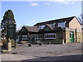
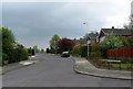
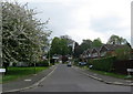
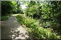
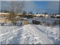
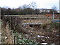
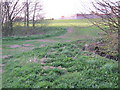
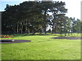
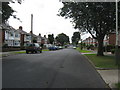
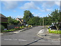
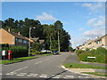
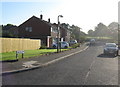
Living in Cockerton Ward offers a distinct blend of rural village charm and proximity to a nearby town. This district borough unitary ward occupies an area of just 1.3 km², situated in the north-west of Darlington. The Cocker Beck flows through the neighbourhood, eventually emptying into the River Skerne via The Denes, a series of valleyed parks donated to the town in the early 20th century. Cockerton retains a recognisable village character within its suburban setting. The original Cockerton Village layout remains intact, featuring a central village green surrounded by well-preserved houses and cottages. Most rebuilding in the area has been carried out sympathetically, ensuring the architecture blends with adjacent surroundings. The entire village is largely covered by the Cockerton Conservation Area, managed by Darlington Borough Council. This ward sits immediately to the north-west of Darlington town centre and borders Mowden, Branksome, West Park, and Faverdale. A collection of mostly independent retailers lines the high street, alongside chain stores like the Co-operative. Residents have access to essential amenities including a post office, pubs, chemists, and varied food retailers. Known local institutions include St. Mary's Church of England, Holy Family Roman Catholic Church, and Cockerton Methodist Church, all located on the village green. Cockerton Library has been housed in its award-winning building since 1970, serving as a community hub. The area attracts those seeking roots in a historic location without being isolated from modern town facilities.
- Area Type
- District Borough Unitary Ward
- Area Size
- 1.3 km²
- Population
- Not available
- Population Density
- Not available
Demographics
The community profile of Cockerton Ward reflects a mature population with significant population stability. The median age in the area stands at 70 years, indicating a neighbourhood where older generations form the majority demographic. While the most common age range category is listed as Age Total, the high median age suggests that amenities and services cater heavily to retirement age needs. Homeownership is established as the primary living arrangement, with 54% of residents owning their homes outright or with a mortgage. This figure indicates a stable, settled population rather than a transient renting market. Household composition and accommodation type data reflect this settled nature, though specific breakdowns of single-person versus family households are not detailed in current records. The ethnic makeup, predominant religion, and other faith-based demographics are recorded generally for the total population. This homogenous profile often correlates with specific community dynamics, including local clubs and regular social events. Safety considerations are visible in the crime statistics, which show a medium crime risk score of 64 out of 100. This level implies that crime rates are around average for the region. Residents are advised to maintain standard security precautions, such as locking doors and securing gardens. Flood risk assessments also reveal a warning level with a score of 13.13. This score indicates medium flood risk coverage, a fact potential buyers must consider when reviewing their specific plot locations near the Cocker Beck.
Household Size
Accommodation Type
Tenure
Ethnic Group
Religion
Household Composition
Age
Household Deprivation
NS-SEC
Explore more demographic insights in this area
Go to Demographics tabPlanning
Planning Constraints
- Flood RiskPremium
- Ramsar Wetland SitesPremium
- Area of Outstanding Natural BeautyPremium
- Protected Nature ReservePremium
- Protected WoodlandPremium