Area Overview for Cleadon Park Ward
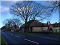
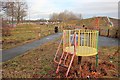
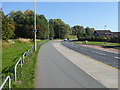
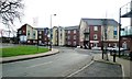
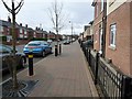
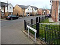
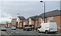
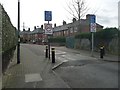
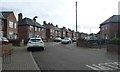
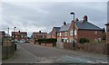
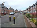
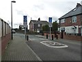
Photos of Cleadon Park Ward
Area Information
Cleadon Park Ward is an electoral ward within South Tyneside Council, situated in the North East of England. This district covers a compact area of 2.0 km² and contains a population of 1,531 residents. You are positioned approximately 5 miles from both Sunderland and South Shields, with the ward lying adjacent to the village of Cleadon on the southwest scarp of Cleadon Hills. The area offers direct access to the A1018, a key road linking South Shields and Sunderland, making local travel straightforward. You are also close to East Boldon Metro station, with bus services operated by Go North East and Stagecoach North East providing further options. The ward is characterised by suburban areas near Cleadon village, which retains roots in a probable medieval layout. Cleadon Conservation Area was designated in 1975 and extended in 2004, protecting the village core and the nearby Cleadon Plantation residential stretch. Coulthard Park, the former grounds of Cleadon House, features a bowling green, tennis courts, and an 18th-century grotto with a blue plaque. Living here means enjoying a setting close to historic landmarks while maintaining reasonable connectivity to larger urban centres like Sunderland. The Ward includes areas that served as training centres during World War I, adding a layer of historical depth to the daily environment for those calling this district home.
- Area Type
- District Borough Unitary Ward
- Area Size
- 2.0 km²
- Population
- 1531
- Population Density
- 760 people/km²
Demographics
The community in Cleadon Park Ward is defined by a significantly older age profile, with a median age of seventy years. The ward is most commonly represented by the 'Total' age range, indicating a broad demographic spread where older residents form a substantial portion. You will find that sixty per cent of households in the area own their homes, suggesting a stable, long-term resident base rather than a transient population. Households, accommodation types, predominant ethnic groups, and religious affiliations are noted as covering the total population, reflecting a complete census picture for this specific ward. There is no data provided on detailed household composition breakdowns such as single-person homes versus families, so you cannot infer specific family structures beyond the general total. Similarly, specific details on the predominant ethnic group or religious makeup are not granularly available for this ward in the current dataset. The absence of specific deprivation scores further limits the ability to comment on economic stratification within the neighbourhood. Consequently, the demographic landscape appears largely traditional, focusing on senior living and home ownership without the volatility of a high-turnover rental market. This data confirms a quiet, established community where residents are likely to have deep roots in the locality.
Household Size
Accommodation Type
Tenure
Ethnic Group
Religion
Household Composition
Age
Household Deprivation
NS-SEC
Explore more demographic insights in this area
Go to Demographics tabPlanning
Planning Constraints
- Flood RiskPremium
- Ramsar Wetland SitesPremium
- Area of Outstanding Natural BeautyPremium
- Protected Nature ReservePremium
- Protected WoodlandPremium
- Crime RiskPremium