Area Overview for Cleadon and East Boldon Ward
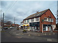
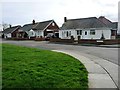
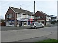
Photos of Cleadon and East Boldon Ward
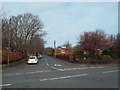
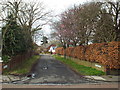
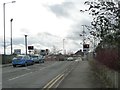
![Junction of Woodlands Road and Whitburn Road [B1299] in Cleadon and East Boldon Ward](https://images.propbar.co.uk/images/geograph/53/02/5302753_120.jpg)
Area Information
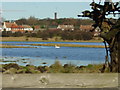
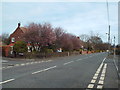
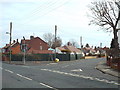
Cleadon and East Boldon Ward stands as a distinct suburban district within South Tyneside, covering an area of 10.9 square kilometres. This ward encompasses the villages of Cleadon and East Boldon, sitting near the boundary with Sunderland and historically part of County Durham before the 1974 reorganisation. The population totals 2,747 residents, creating a notably quiet environment compared to larger urban centres. You will find a landscape defined by semi-rural village layouts where historic centres blend with post-war housing estates. Cleadon retains its character as a conservation area designated in 1975 and expanded in 2004, protecting its historic layout. East Boldon operates as a commuter settlement linked to Sunderland by early railway lines, fostering a settled, green atmosphere. The area is not dominated by commercial high streets but rather by village centres, open moors, and residential zones. Coulthard Park and Cleadon Park provide significant green spaces, while historic sites like the village pinfold on West Park Road anchor the local history. Living here means accessing a community that has evolved from medieval settlements and Civil War battlegrounds into a peaceful modern neighbourhood. The ward offers a specific type of life where proximity to major roads like the A1018 coexists with the tranquility of a suburb. Residents appreciate the integration of nature, with nearby Boldon Hills and Peter Allan's Grotto adding natural interest to the local scene.
- Area Type
- District Borough Unitary Ward
- Area Size
- 10.9 km²
- Population
- 2747
- Population Density
- 253 people/km²
Demographics
You will find a community defined by stability and an older population in Cleadon and East Boldon Ward. The median age of residents is 70, making the area significantly older than the national average. This demographic profile suggests the ward is a retirement destination or a family area where those who birth children have aged significantly in place. Out of the total population, age constitutes the primary statistical descriptor available, highlighting a homogenous group in terms of life stage. Home ownership is the defining characteristic of this community, with 91% of households owning their properties outright or with a mortgage. This statistic indicates a long-term resident base rather than a transient rental market. The high rate of ownership often correlates with families and seniors staying in their neighbourhoods for decades. While specific data on ethnic diversity and religious breakdown is not detailed in the provided records, the area functions as a cohesive unit where residents share the same settlement history. The ward reflects a planned evolution from a medieval settlement recorded by 1170 to a modern suburb that maintained its residential focus through the 20th century. This demographic stability creates an environment where community facilities and local services cater to an aging population. You can expect neighbourhood interactions to be rooted in a shared history rather than the turnover typical of urban student zones or new-build estates elsewhere in the region.
Household Size
Accommodation Type
Tenure
Ethnic Group
Religion
Household Composition
Age
Household Deprivation
NS-SEC
Explore more demographic insights in this area
Go to Demographics tabPlanning
Planning Constraints
- Flood RiskLocked
- Ramsar Wetland SitesLocked
- Area of Outstanding Natural BeautyLocked
- Protected Nature ReserveLocked
- Protected WoodlandLocked
- Crime RiskLocked