Area Overview for Cassop-cum-Quarrington
Photos of Cassop-cum-Quarrington
Area Information
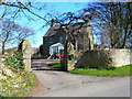
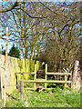
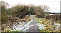
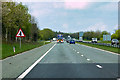
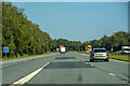
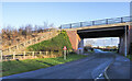
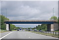
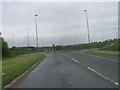
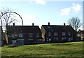
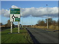
Cassop-cum-Quarrington is a civil parish within County Durham that spans a total of 14.3 km². You will find a collection of distinct settlements here, including Cassop, Quarrington Hill, Old Quarrington, Old Cassop, Bowburn, Parkhill and Tursdale. The parish sits near the city of Durham at coordinates approximately 54.7357°N, 1.5076°W. This area came into existence in 1887 when the townships of Cassop and Quarrington merged, though boundaries shifted again in 1946, 1953 and 2014. Daily life here is shaped by deep historical roots rather than modern urban development. Old Cassop shows earthwork traces of Roman or Iron Age origins, while Old Quarrington served as the capital of medieval Quarringtonshire. Quarrington Hill hosted military encampments, including Scots forces under the Earl of Leven in 1644. Industrial history also defines the landscape, with coal mining beginning in the 19th century at collieries like Heugh Hall and Cassop Moor. St. Paul's Church, built in 1867 at Quarrington Hill, remains a central landmark alongside earthwork remains of medieval ridge and furrow farming. For residents living in Cassop-cum-Quarrington, the environment blends agricultural heritage with accessible proximity to the wider North East region.
- Area Type
- Parish
- Area Size
- 14.3 km²
- Population
- Not available
- Population Density
- Not available
Demographics
The community profile of Cassop-cum-Quarrington presents a notable absence of young families compared to national averages. The median age across the parish is recorded at 70, a figure that indicates a population dominated by older residents. You are looking at a community where the most common age range groups are centred on this high median rather than younger brackets. This demographic reality suggests a quiet, settled neighbourhood rather than a dynamic, youthful hub. Regarding housing stability, 65% of homes in Cassop-cum-Quarrington are owner-occupied. This high rate of ownership strengthens the sense of permanence within the parish. Household composition data indicates that the total population structure aligns with this older median age, meaning you will encounter fewer single-person homes of young adults and more multi-generational or downsized households. While specific data on predominant ethnic groups and religious affiliation is not broken out in the current statistics, the primary demographic character remains defined by age and tenure. For anyone considering living in this area, the social fabric is built around established families and long-term residents who have remained in the parish for decades.
Household Size
Accommodation Type
Tenure
Ethnic Group
Religion
Household Composition
Age
Household Deprivation
NS-SEC
Explore more demographic insights in this area
Go to Demographics tabPlanning
Planning Constraints
- Flood RiskPremium
- Ramsar Wetland SitesPremium
- Area of Outstanding Natural BeautyPremium
- Protected Nature ReservePremium
- Protected WoodlandPremium
- Crime RiskPremium