Area Overview for Carlin How
Photos of Carlin How


Area Information
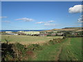
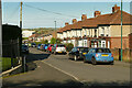
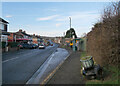
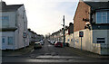
Carlin How is a built-up area spanning 50 hectares, nestled in England. With a median age of 70, it reflects a community shaped by older generations, offering a distinct character that blends quiet stability with accessible amenities. Daily life here is defined by proximity to essential services, including three nearby railway stations—Saltburn, Marske, and Longbeck—which connect residents to broader regional networks. The area’s broadband connectivity is excellent, scoring 97, ensuring seamless digital experiences for work and leisure. For families, the presence of Whitecliffe Primary School and Whitecliffe Academy provides a range of educational options within reach. Carlin How’s compact size fosters a sense of familiarity, where local shops like Spar, Morrisons Daily, and Co-op Loftus cater to everyday needs. While the population is older on average, the area remains functional and well-served, balancing simplicity with practicality for those seeking a settled lifestyle without sacrificing convenience.
- Area Type
- Built Up Area 250
- Area Size
- 50.0 hectares
- Population
- Not available
- Population Density
- Not available
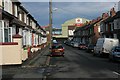
Carlin How offers a range of amenities within easy reach, contributing to a practical lifestyle. Local retail options include Spar, Morrisons Daily, and Co-op Loftus, providing everyday essentials and convenience for residents. The three nearby railway stations—Saltburn, Marske, and Longbeck—add to the area’s accessibility, allowing quick travel to surrounding areas for shopping, dining, or leisure. While the data does not detail parks or recreational spaces, the presence of these amenities suggests a focus on functional living. The compact nature of the area means residents can access necessities without long commutes, fostering a self-contained community. The mix of retail and transport options supports a balanced lifestyle, where daily needs are met efficiently, and the area’s character is defined by its simplicity and connectivity.
Amenities
Schools
Residents of Carlin How have access to two educational institutions: Whitecliffe Primary School, which provides early years and primary education, and Whitecliffe Academy, a secondary school offering further academic and vocational pathways. While the data does not include Ofsted ratings, the presence of both a primary and secondary school within the area ensures a continuous educational journey for families. The mix of school types may cater to diverse learning needs, from foundational education to more specialised secondary-level studies. For parents, this proximity reduces commuting time and supports a balanced lifestyle. However, without performance data, prospective families are advised to visit schools directly to assess quality and alignment with their child’s needs. The availability of both primary and secondary schooling is a key consideration for those prioritising educational convenience in their choice of residence.
| Rank | A + A* % | School | Type | Entry gender | Ages |
|---|---|---|---|---|---|
| 1 | N/A | Whitecliffe Primary School | primary | N/A | N/A |
| 2 | N/A | Whitecliffe Academy | academy | N/A | N/A |
Explore more schools in this area
Go to Schools tabDemographics
Carlin How’s population has a median age of 70, with the most common age range encompassing all demographics. Home ownership stands at 62%, indicating a majority of residents live in properties they own. The data does not specify household composition or accommodation types, but the overall profile suggests a community with established residents. The area’s age profile implies a population that may be more retired or long-term settled, which can influence local dynamics and service needs. While no explicit data on diversity or deprivation is provided, the 62% home ownership rate suggests a degree of economic stability. This demographic structure shapes the area’s character, where older residents may prioritise ease of access to amenities and reliable infrastructure, reflected in the availability of nearby retail and transport links.
Household Size
Accommodation Type
Tenure
Ethnic Group
Religion
Household Composition
Age
Household Deprivation
NS-SEC
Explore more demographic insights in this area
Go to Demographics tabPlanning
Planning Constraints
- Crime RiskLocked