Area Overview for Burnhope
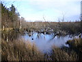
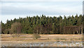
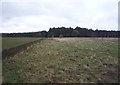
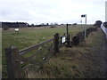
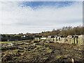
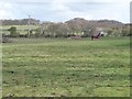
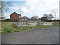
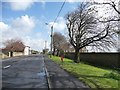
Photos of Burnhope
Area Information
Burnhope is a built-up area in England covering 52.1 hectares, characterised by its mature community and established infrastructure. With a median age of 70, it is a settlement where many residents have lived for decades, contributing to a sense of continuity. The area is home to 73% owner-occupiers, reflecting a stable housing market. Daily life in Burnhope is shaped by its proximity to essential services, including retail outlets like Spar and Tesco Stanley, and rail links to Bullion Lane, Chester, and Station Road. While the broadband score is low at 27, mobile coverage is strong at 82, supporting connectivity for remote work and communication. The presence of Burnhope Primary School, though listed twice in the data, indicates a focus on local education. Living in Burnhope offers a blend of practical convenience and a quiet, settled environment, ideal for those prioritising stability over fast-paced urban living.
- Area Type
- Built Up Area 250
- Area Size
- 52.1 hectares
- Population
- Not available
- Population Density
- Not available
Burnhope’s lifestyle is shaped by its proximity to retail and transport hubs. Five retail outlets, including Spar and Tesco Stanley, provide convenient shopping options for essentials. The rail stations at Bullion Lane, Chester, and Station Road offer easy access to nearby destinations, supporting both daily commutes and leisure travel. While the data does not mention parks or leisure facilities, the presence of multiple retail and transport points suggests a practical, community-focused environment. The area’s small size and mature population likely foster a quiet, low-key lifestyle, with amenities tailored to local needs. For residents, Burnhope balances convenience with simplicity, ideal for those seeking a settled, uncluttered way of life.
Amenities
Schools
Burnhope Primary School is the only educational institution listed in the data, though it appears twice. As a primary school, it serves the local community, providing education for younger residents. The duplication in the data may indicate a need for clarification, but the presence of a primary school suggests that families with young children have access to local schooling. However, there is no information on secondary schools or Ofsted ratings, so the full range of educational options remains unclear. For families prioritising proximity to schools, Burnhope Primary School is a key consideration, though further research would be needed to assess its quality or additional facilities.
| Rank | A + A* % | School | Type | Entry gender | Ages |
|---|---|---|---|---|---|
| 1 | N/A | Burnhope Primary School | primary | N/A | N/A |
| 2 | N/A | Burnhope Primary School | primary | N/A | N/A |
Explore more schools in this area
Go to Schools tabDemographics
Burnhope’s population has a median age of 70, the highest of any age group, suggesting a community dominated by older adults. This demographic profile influences the area’s character, with households likely to be smaller or consist of retirees. Home ownership is high at 73%, indicating a strong presence of long-term residents. The data does not specify household composition or accommodation types, but the overall figures suggest a population that values stability and established living. The absence of detailed diversity metrics means the community’s ethnic and religious makeup remains unspecified. However, the high home ownership rate implies a relatively cohesive, long-settled population. For those considering Burnhope, the age profile and ownership statistics highlight a mature, low-turnover environment, which may appeal to buyers seeking a quiet, unchanging neighbourhood.
Household Size
Accommodation Type
Tenure
Ethnic Group
Religion
Household Composition
Age
Household Deprivation
NS-SEC
Explore more demographic insights in this area
Go to Demographics tabPlanning
Planning Constraints
- Crime RiskLocked