Area Overview for Brinkburn & Faverdale Ward
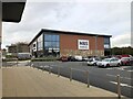
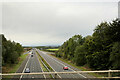
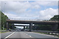
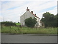
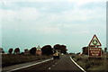
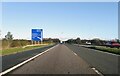
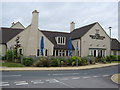
Photos of Brinkburn & Faverdale Ward

Area Information
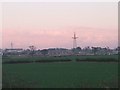
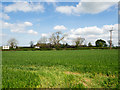
Living in Brinkburn & Faverdale Ward offers a defined rural experience within a compact boundary of just 8.7 square kilometres. This district borough unitary ward sits in England, providing a focused residential environment where space and community intersect. The area is small enough to create an intimate setting, yet structured as a formal ward within the local authority. Prospective buyers here are entering a market that reflects its specific geographical constraints and demographic realities. You will find that daily life centres on the narrow footprint of the ward, which lacks the sprawling infrastructure of larger urban districts. The scale of the area influences how you interact with your surroundings, making the location a distinct choice from more expansive regions. There is no complex web of planning constraints or protected natural reserves to navigate within these borders, simplifying certain aspects of the property landscape. Instead, you encounter a straightforward setting characterised by its flat estate structure. Residents here adapt to a community defined by its size and stability rather than rapid growth or diverse urban amenities. This clarity makes the decision to buy property in Brinkburn & Faverdale Ward a matter of accepting a specific, manageable slice of the wider countryside.
- Area Type
- District Borough Unitary Ward
- Area Size
- 8.7 km²
- Population
- Not available
- Population Density
- Not available
Demographics
The community profile of Brinkburn & Faverdale Ward presents a clear picture of a mature resident population. You will find that the median age across the ward is 70 years, indicating a settlement dominated by older adults. This age demographic shapes the rhythm of life here, with most residents falling into the older age bracket rather than representing a youth-driven zone. Households in Brinkburn & Faverdale Ward reflect this reality, built around stability and long-term residence rather than transient commutes. Data shows that 72% of homes are owned outright, revealing a strong culture of property ownership within the ward. This high level of home ownership suggests that you are likely to encounter owners who have lived in the area for decades rather than tenants seeking short-term leases. The ward does not contain specific data on primary ethnicity or religious breakdown, but the overall statistical profile points to a uniform group demographically. There are no major youth demographics driving the local economy or social scene. Instead, the population structure supports a quiet, settled way of living where residents have rooted themselves deeply. For anyone buying a home in Brinkburn & Faverdale Ward, the environment feels established and unchanging, catering primarily to those seeking a retired lifestyle or permanent retirement location rather than a destination for families with young children.
Household Size
Accommodation Type
Tenure
Ethnic Group
Religion
Household Composition
Age
Household Deprivation
NS-SEC
Explore more demographic insights in this area
Go to Demographics tabPlanning
Planning Constraints
- Flood RiskPremium
- Ramsar Wetland SitesPremium
- Area of Outstanding Natural BeautyPremium
- Protected Nature ReservePremium
- Protected WoodlandPremium